|
search place name
|
||
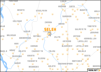
Seleh (Margibi, Liberia)Seleh is a town in the Margibi region of Liberia. An overview map of the region around Seleh is displayed below.
regional and 3d topo map of Seleh, Liberia ::
Seleh airports ::
The nearest airport is ROB - Monrovia Roberts Intl, located 49.3 km south of Seleh.
Other airports nearby include MLW - Monrovia Spriggs Payne (58.0 km south west), Nearby towns ::
Bonazabli (1.2km west) //
Yagapua (1.3km north west) //
Vilita (3.0km south east) //
Malony (3.2km west) //
Zannah (4.0km north) //
Palmer Camp (4.5km east) //
Thomas Camp (4.8km west) //
Motobli (4.9km west) //
Moinia (5.4km north east) //
Gonubli (5.4km west) //
Cooper Farm (5) (5.4km south east) //
Larketa (6.1km east) //
Lango Number Two (6.1km east) //
Numata (6.3km east) //
Dennis Farm (6.4km east) //
Yalimu (6.8km south) //
Vayenma (7.0km south east) //
Kasavam (7.0km south east) //
Sagabita (7.2km south) //
Kiangai (7.6km south west) //
Padmore Farm (7.7km north east) //
Booten (7.7km north west) //
Blair Camp (8.0km south east) //
Roberts Camp (8.0km south) //
Blokoan (8.1km north) //
Murray Farm (8.1km south east) //
Napita (8.1km south east) //
Kolicairn (8.2km south east) //
Chunkeyta (8.3km south west) //
[all distances 'as the bird flies' and approximate] 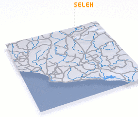 Places with similar names to Seleh, Liberia ::
Disclaimer :: Information on this page comes without warranty of any kind |
||
|
Where is Seleh? Elevation and coordinates ::
Latitude (lat): 6°40'39"N Longitude (lon): 10°24'25"W
Elevation (approx.): 140m (map arrows pan, magnifying glasses zoom) |
||
|
Visiting Seleh? Hotel/Accommodation ::
Book a hotel in Seleh Travel Guide ::
Buy a travel guide for Liberia rental cars ::
car rental offers GPS waypoint ::
download a GPX waypoint (PoI) of Seleh for your GPS receiver
|
||