|
search place name
|
||
Dol-Suha (Cankova-Tišina, Slovenia)Dol-Suha is a town in the Cankova-Tišina region of Slovenia. An overview map of the region around Dol-Suha is displayed below.
regional and 3d topo map of Dol-Suha, Slovenia ::

Dol-Suha airports ::
The nearest airport is LJU - Ljubliana Ljubljana, located 37.4 km west of Dol-Suha.
Other airports nearby include KLU - Klagenfurt (Worthersee Intl) (56.2 km north west), MBX - Maribor (61.4 km east), GRZ - Graz (83.4 km north east), ZAG - Zagreb (110.7 km south east), Nearby towns ::
Rečica ob Savinji (1.9km south) //
Radegunda (2.3km north east) //
Žlabor (3.2km south east) //
Zgornje Pobrezje (3.9km south) //
Spodnje Pobrežje (3.9km south) //
Šentjanž (3.2km south west) //
Mozirje (3.6km east) //
Kokarje (4.5km south east) //
Okonina (3.8km west) //
Brezje (4.3km north east) //
Šmartno ob Dreti (5.9km south) //
Šmihel nad Mozirjem (6.1km north east) //
Loke pri Mozirju (4.7km east) //
Radmirje (5.0km west) //
Ljubija (5.4km east) //
Lepa Njiva (6.3km north east) //
Bočna (6.8km south west) //
Bele Vode (9.4km north) //
Stopnik (9.0km south east) //
[all distances 'as the bird flies' and approximate] 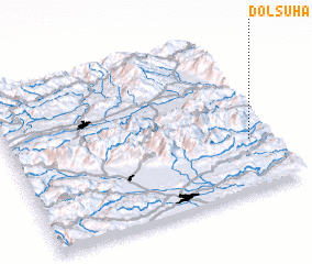 Places with similar names to Dol-Suha, Slovenia ::
// Dēlēzha (IQ)
// Dal'zha (RU)
// Dolzha (RU)
// Delli-Sahé (BJ)
// Tolosahay (PH)
// Taolaizhao (CN)
Disclaimer :: Information on this page comes without warranty of any kind |
||
|
Where is Dol-Suha? Elevation and coordinates ::
Latitude (lat): 46°20'0"N Longitude (lon): 14°55'0"E
Elevation (approx.): 388m (map arrows pan, magnifying glasses zoom) |
||
|
Visiting Dol-Suha? Hotel/Accommodation ::
Book a hotel in Dol-Suha Travel Guide ::
Buy a travel guide for Slovenia rental cars ::
car rental offers GPS waypoint ::
download a GPX waypoint (PoI) of Dol-Suha for your GPS receiver
|
||