|
search place name
|
||
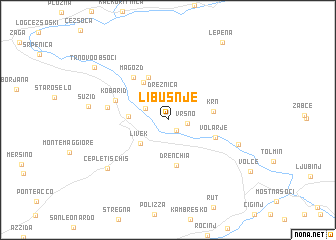
Libušnje (Cankova-Tišina, Slovenia)Libušnje is a town in the Cankova-Tišina region of Slovenia. An overview map of the region around Libušnje is displayed below.
regional and 3d topo map of Libušnje, Slovenia ::
Libušnje airports ::
The nearest airport is TRS - Ronchi De Legionari Ronchi Dei Legionari, located 46.2 km south of Libušnje.
Other airports nearby include LJU - Ljubliana Ljubljana (63.8 km east), KLU - Klagenfurt (Worthersee Intl) (71.3 km north east), AVB - Aviano Ab (Pagliano E Gori) (82.8 km west), POW - Portoroz (83.9 km south), Nearby towns ::
Kamno (1.3km south east) //
Vrsno (1.6km east) //
Ladra (2.2km north west) //
Drežnica (2.9km north) //
Livek (3.4km south west) //
Idrsko (3.0km west) //
Jezerca (4.5km north west) //
Krn (3.6km east) //
Drenchia (5.1km south) //
Drežniške Ravne (5.0km north) //
Volarje (4.1km south east) //
Magozd (5.4km north west) //
Kobarid (4.6km north west) //
Svino (4.8km west) //
Gabrje (6.1km south east) //
Cepletischis (7.2km south west) //
Sužid (6.3km west) //
Trnovo ob Soči (8.1km north west) //
Lepena (9.6km north east) //
[all distances 'as the bird flies' and approximate] 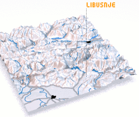 Places with similar names to Libušnje, Slovenia :: Disclaimer :: Information on this page comes without warranty of any kind |
||
|
Where is Libušnje? Elevation and coordinates ::
Latitude (lat): 46°13'42"N Longitude (lon): 13°37'48"E
Elevation (approx.): 600m (map arrows pan, magnifying glasses zoom) |
||
|
Visiting Libušnje? Hotel/Accommodation ::
Book a hotel in Libušnje Travel Guide ::
Buy a travel guide for Slovenia rental cars ::
car rental offers GPS waypoint ::
download a GPX waypoint (PoI) of Libušnje for your GPS receiver
|
||