|
search place name
|
||
Rajhenav (Cankova-Tišina, Slovenia)Rajhenav is a town in the Cankova-Tišina region of Slovenia. An overview map of the region around Rajhenav is displayed below.
regional and 3d topo map of Rajhenav, Slovenia ::

Rajhenav airports ::
The nearest airport is RJK - Rijeka, located 57.2 km south west of Rajhenav.
Other airports nearby include LJU - Ljubliana Ljubljana (77.7 km north west), ZAG - Zagreb (84.4 km east), MBX - Maribor (108.1 km north east), POW - Portoroz (109.4 km west), Nearby towns ::
Podstene (1.6km east) //
Staro Brezje (3.7km south) //
Mačkovec (3.4km south west) //
Onek (3.9km south west) //
Koprivnik (4.6km south east) //
Suhi Potok (6.0km south west) //
Kačji Potok (6.3km south) //
Hrib pri Koprivniku (6.4km south east) //
(( Novi Breg )) (6.5km north west) //
Svetli Potok (7.7km south) //
Mozelj (7.3km south west) //
Rajndol (8.4km south west) //
Nemška Loka (9.2km south east) //
Stari Breg (8.4km north west) //
Bukova Gora (9.3km south east) //
[all distances 'as the bird flies' and approximate] 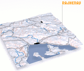 Places with similar names to Rajhenav, Slovenia :: Disclaimer :: Information on this page comes without warranty of any kind |
||
|
Where is Rajhenav? Elevation and coordinates ::
Latitude (lat): 45°38'4"N Longitude (lon): 14°59'48"E
Elevation (approx.): 665m (map arrows pan, magnifying glasses zoom) |
||
|
Visiting Rajhenav? Hotel/Accommodation ::
Book a hotel in Rajhenav Travel Guide ::
Buy a travel guide for Slovenia rental cars ::
car rental offers GPS waypoint ::
download a GPX waypoint (PoI) of Rajhenav for your GPS receiver
|
||