|
search place name
|
||
Šmarjeta (Cankova-Tišina, Slovenia)Šmarjeta is a town in the Cankova-Tišina region of Slovenia. An overview map of the region around Šmarjeta is displayed below.
regional and 3d topo map of Šmarjeta, Slovenia ::

Šmarjeta airports ::
The nearest airport is ZAG - Zagreb, located 65.5 km east of Šmarjeta.
Other airports nearby include LJU - Ljubliana Ljubljana (72.1 km north west), MBX - Maribor (74.4 km north east), RJK - Rijeka (91.1 km south west), KLU - Klagenfurt (Worthersee Intl) (109.9 km north west), Nearby towns ::
Gorenja Vas pri Šmarjeti (0.1km south) //
Zbure (2.5km north) //
Bela Cerkev (2.3km south east) //
Vinica pri Šmarjeti (2.3km north east) //
Otočec (2.5km south east) //
Gorenje Kronovo (3.7km south) //
Dolenje Kronovo (3.7km south) //
Male Poljane (3.7km north) //
Velike Poljane (3.7km north) //
Žaloviče (3.2km south west) //
Dolnja Stara Vas (3.2km north east) //
Velika Strmica (3.2km north west) //
Mala Strmica (3.2km north west) //
Čelevec (4.5km north west) //
Škocjan (4.1km north east) //
Zagrad (5.6km north) //
Čadraže (4.3km south east) //
Grmovlje (4.3km north east) //
Dobruška Vas (4.5km east) //
Dolenje Grčevje (5.4km south west) //
Dolenje Mokro Polje (6.1km south east) //
Gorenje Grčevje (5.4km south west) //
Gorenje Mokro Polje (6.1km south east) //
Gorenji Maharovec (5.4km south east) //
Dolenji Maharovec (5.4km south east) //
Srednje Grčevje (5.4km south west) //
Gorenje Dole (6.1km north east) //
Dolenje Dole (6.1km north east) //
Krsinji Vrh (6.1km north west) //
[all distances 'as the bird flies' and approximate] 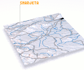 Places with similar names to Šmarjeta, Slovenia ::
// Sumbargede (ID)
// Sumberjati (ID)
// Sumurgede (ID)
// Somar Jat (PK)
// Sūmar Jatoi (PK)
// Sumurgeda (ID)
Disclaimer :: Information on this page comes without warranty of any kind |
||
|
Where is Šmarjeta? Elevation and coordinates ::
Latitude (lat): 45°53'0"N Longitude (lon): 15°15'0"E
Elevation (approx.): 181m (map arrows pan, magnifying glasses zoom) |
||
|
Visiting Šmarjeta? Hotel/Accommodation ::
Book a hotel in Šmarjeta Travel Guide ::
Buy a travel guide for Slovenia rental cars ::
car rental offers GPS waypoint ::
download a GPX waypoint (PoI) of Šmarjeta for your GPS receiver
|
||