|
search place name
|
||
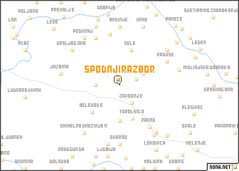
Spodnji Razbor (Cankova-Tišina, Slovenia)Spodnji Razbor is a town in the Cankova-Tišina region of Slovenia. An overview map of the region around Spodnji Razbor is displayed below.
regional and 3d topo map of Spodnji Razbor, Slovenia ::
Spodnji Razbor airports ::
The nearest airport is LJU - Ljubliana Ljubljana, located 48.8 km south west of Spodnji Razbor.
Other airports nearby include MBX - Maribor (52.8 km east), KLU - Klagenfurt (Worthersee Intl) (55.1 km north west), GRZ - Graz (68.9 km north east), ZAG - Zagreb (114.0 km south east), Nearby towns ::
Zgornji Razbor (2.1km north east) //
Zavodnje (3.0km south east) //
Šentvid pri Zavodnju (2.6km west) //
Sveti Duh (3.2km north east) //
Sveti Florijan pri Šoštanju (5.6km south) //
Topolšica (5.4km south) //
Sele (5.7km north) //
Bele Vode (5.1km south west) //
Ravne (7.2km south east) //
Kotlje (8.0km north) //
Raduše (6.3km north east) //
Podgora (7.8km north) //
Gabrke (8.3km south east) //
Uršlja Gora (7.5km north west) //
Stari Trg (7.5km north east) //
Podkraj (8.3km north west) //
Šmihel nad Mozirjem (8.3km south west) //
Šoštanj (8.6km south east) //
Družmirje (9.4km south east) //
[all distances 'as the bird flies' and approximate] 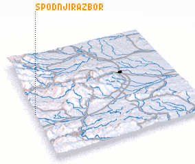 Places with similar names to Spodnji Razbor, Slovenia :: Disclaimer :: Information on this page comes without warranty of any kind |
||
|
Where is Spodnji Razbor? Elevation and coordinates ::
Latitude (lat): 46°27'0"N Longitude (lon): 15°0'0"E
Elevation (approx.): 947m (map arrows pan, magnifying glasses zoom) |
||
|
Visiting Spodnji Razbor? Hotel/Accommodation ::
Book a hotel in Spodnji Razbor Travel Guide ::
Buy a travel guide for Slovenia rental cars ::
car rental offers GPS waypoint ::
download a GPX waypoint (PoI) of Spodnji Razbor for your GPS receiver
|
||