|
search place name
|
||
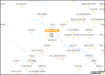
Dubová (Slovakia)Dubová is a town in Slovakia. An overview map of the region around Dubová is displayed below.
regional and 3d topo map of Dubová, Slovakia ::
Dubová airports ::
The nearest airport is BTS - Bratislava M R Stefanik, located 23.6 km south of Dubová.
Other airports nearby include PZY - Piestany (46.5 km north east), VIE - Vienna Schwechat (63.5 km south west), BRQ - Turany (99.1 km north west), PRV - Prerov (117.9 km north), Nearby towns ::
Harmónia (1.2km west) //
Kráľová (1.9km south) //
Píla (3.7km north) //
Modra (3.9km south) //
Častá (4.4km north east) //
Lindava (3.7km east) //
Malé Trnie (6.1km south west) //
Horný Dvor (4.9km east) //
Piesok (5.3km west) //
Štefanová (5.3km east) //
Veľké Čaníkovce (7.5km south) //
Doľany (6.7km north east) //
Veľké Trnie (6.7km south west) //
Karlubek (7.8km north) //
Vištuk (6.2km south east) //
Malé Čaníkovce (7.8km south) //
Pusta Silárd (7.4km south east) //
Cajla (8.9km south west) //
[all distances 'as the bird flies' and approximate]  Places with similar names to Dubová, Slovakia ::
Disclaimer :: Information on this page comes without warranty of any kind |
||
|
Where is Dubová? Elevation and coordinates ::
Latitude (lat): 48°22'0"N Longitude (lon): 17°20'0"E
Elevation (approx.): 237m (map arrows pan, magnifying glasses zoom) |
||
|
Visiting Dubová? Hotel/Accommodation ::
Book a hotel in Dubová Travel Guide ::
Buy a travel guide for Slovakia rental cars ::
car rental offers GPS waypoint ::
download a GPX waypoint (PoI) of Dubová for your GPS receiver
|
||