|
search place name
|
||
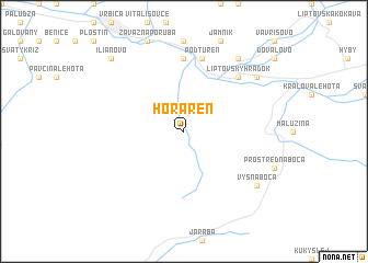
Horáreň (Slovakia)Horáreň is a town in Slovakia. An overview map of the region around Horáreň is displayed below.
regional and 3d topo map of Horáreň, Slovakia ::
Horáreň airports ::
The nearest airport is TAT - Poprad Tatry, located 42.0 km east of Horáreň.
Other airports nearby include SLD - Sliac (55.7 km south west), KSC - Kosice (119.8 km east), KRK - Krakow Balice (121.9 km north), OSR - Ostrava Mosnov (139.1 km north west), Nearby towns ::
Liptovský Ján (7.4km north) //
Podtureň (7.5km north) //
Liptovský Hrádok (6.6km north east) //
Vyšná Boca (7.4km south east) //
Liptovský Svätý Peter (8.3km north east) //
Liptovská Porúbka (7.4km north east) //
Ilianovo (8.9km north west) //
[all distances 'as the bird flies' and approximate] 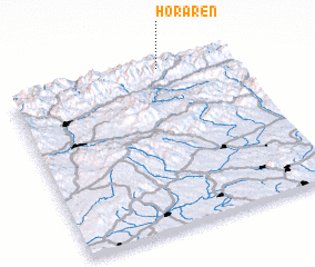 Places with similar names to Horáreň, Slovakia ::
// Whareorino (NZ)
// Huareuaren (CO)
// Harārān (IR)
// Harārān (PK)
// Huarurune (PE)
// Horáreň (SK)
Disclaimer :: Information on this page comes without warranty of any kind |
||
|
Where is Horáreň? Elevation and coordinates ::
Latitude (lat): 48°59'0"N Longitude (lon): 19°41'0"E
Elevation (approx.): 904m (map arrows pan, magnifying glasses zoom) |
||
|
Visiting Horáreň? Hotel/Accommodation ::
Book a hotel in Horáreň Travel Guide ::
Buy a travel guide for Slovakia rental cars ::
car rental offers GPS waypoint ::
download a GPX waypoint (PoI) of Horáreň for your GPS receiver
|
||