|
search place name
|
||
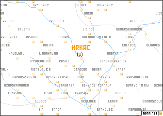
Hrkáč (Slovakia)Hrkáč is a town in Slovakia. An overview map of the region around Hrkáč is displayed below.
regional and 3d topo map of Hrkáč, Slovakia ::
Hrkáč airports ::
The nearest airport is TAT - Poprad Tatry, located 65.7 km north of Hrkáč.
Other airports nearby include KSC - Kosice (73.4 km east), SLD - Sliac (86.5 km west), BUD - Budapest Ferihegy (139.4 km south west), DEB - Debrecen (148.7 km south east), Nearby towns ::
Šankovce (0.0km north) //
Levkuška (2.2km south west) //
Otročok (3.7km south) //
Rašice (3.1km south west) //
Dolinka (3.9km north) //
Gemer (4.4km south east) //
Leváre (4.4km north west) //
Žiar (5.6km south) //
Licince (5.7km north) //
Meliata (5.2km north east) //
Ilonahalma (4.9km west) //
Bretka (4.9km east) //
Polina (5.3km west) //
Behynce (7.5km south) //
Gemerská Panica (5.3km east) //
Vyšná Kaloša (6.7km south west) //
Starňa (6.7km south east) //
Pusta Dapša (7.8km south) //
Králik (7.8km south) //
Gemerské Michalovce (7.4km south west) //
Nižná Kaloša (8.3km south west) //
Tornaľa (8.3km south east) //
Držkovce (8.3km north west) //
[all distances 'as the bird flies' and approximate] 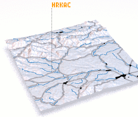 Places with similar names to Hrkáč, Slovakia ::
Disclaimer :: Information on this page comes without warranty of any kind |
||
|
Where is Hrkáč? Elevation and coordinates ::
Latitude (lat): 48°29'0"N Longitude (lon): 20°17'0"E
Elevation (approx.): 193m (map arrows pan, magnifying glasses zoom) |
||
|
Visiting Hrkáč? Hotel/Accommodation ::
Book a hotel in Hrkáč Travel Guide ::
Buy a travel guide for Slovakia rental cars ::
car rental offers GPS waypoint ::
download a GPX waypoint (PoI) of Hrkáč for your GPS receiver
|
||