|
search place name
|
||
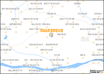
Mudroňovo (Slovakia)Mudroňovo is a town in Slovakia. An overview map of the region around Mudroňovo is displayed below.
regional and 3d topo map of Mudroňovo, Slovakia ::
Mudroňovo airports ::
The nearest airport is BUD - Budapest Ferihegy, located 83.2 km south east of Mudroňovo.
Other airports nearby include BTS - Bratislava M R Stefanik (90.5 km north west), PZY - Piestany (95.2 km north), SLD - Sliac (108.1 km north east), VIE - Vienna Schwechat (134.0 km west), Nearby towns ::
Horáreň (1.2km west) //
Modrany (2.5km east) //
Šrobárová (3.7km south) //
Podháj (3.9km north) //
Marcelová (5.7km south) //
Svätý Peter (4.2km north west) //
Sedmerovce (5.3km south west) //
Krátke Kesy (6.1km south west) //
Dulovce (5.3km north west) //
Pribeta (7.4km north) //
Žitva (7.5km south) //
Svätý Štefan (6.7km north east) //
Perbetský Dvor (6.7km north east) //
Antonov Sad (6.2km north east) //
Balogovská Pusta (8.3km south east) //
Dolná Pustatina (7.5km north east) //
Nová Trstená (7.5km north west) //
[all distances 'as the bird flies' and approximate] 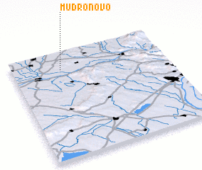 Places with similar names to Mudroňovo, Slovakia ::
// Madarounfa (NE)
// Materia Nueva (VE)
Disclaimer :: Information on this page comes without warranty of any kind |
||
|
Where is Mudroňovo? Elevation and coordinates ::
Latitude (lat): 47°50'0"N Longitude (lon): 18°19'0"E
Elevation (approx.): 160m (map arrows pan, magnifying glasses zoom) |
||
|
Visiting Mudroňovo? Hotel/Accommodation ::
Book a hotel in Mudroňovo Travel Guide ::
Buy a travel guide for Slovakia rental cars ::
car rental offers GPS waypoint ::
download a GPX waypoint (PoI) of Mudroňovo for your GPS receiver
|
||