|
search place name
|
||
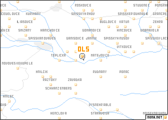
Olš (Slovakia)Olš is a town in Slovakia. An overview map of the region around Olš is displayed below.
regional and 3d topo map of Olš, Slovakia ::
Olš airports ::
The nearest airport is TAT - Poprad Tatry, located 34.6 km north west of Olš.
Other airports nearby include KSC - Kosice (51.8 km south east), SLD - Sliac (115.6 km west), KRK - Krakow Balice (143.5 km north west), RZE - Rzeszow Jasionka (165.7 km north east), Nearby towns ::
Markušovce (1.2km west) //
Odorín (2.2km north west) //
Matejovce (2.4km east) //
Lieskovany (3.1km north west) //
Danišovce (3.9km north) //
Jamník (3.9km north) //
Rudňany (4.4km south east) //
Teplička (3.7km west) //
Chrasť nad Hornádom (4.1km north east) //
Závadka (5.7km south) //
Domanovce (5.7km north) //
Nálepkovo (7.5km south) //
Spišský Hrušov (6.1km north east) //
Bindt (6.1km south west) //
Buglovce (8.3km north east) //
Schwarzenberg (8.3km south west) //
Ráztoky (7.4km south west) //
Harichovce (7.4km north west) //
Baldovce (8.9km north east) //
[all distances 'as the bird flies' and approximate]  Places with similar names to Olš, Slovakia ::
Disclaimer :: Information on this page comes without warranty of any kind |
||
|
Where is Olš? Elevation and coordinates ::
Latitude (lat): 48°55'0"N Longitude (lon): 20°39'0"E
Elevation (approx.): 436m (map arrows pan, magnifying glasses zoom) |
||
|
Visiting Olš? Hotel/Accommodation ::
Book a hotel in Olš Travel Guide ::
Buy a travel guide for Slovakia rental cars ::
car rental offers GPS waypoint ::
download a GPX waypoint (PoI) of Olš for your GPS receiver
|
||