|
search place name
|
||
Pohronský Ruskov (Slovakia)Pohronský Ruskov is a town in Slovakia. An overview map of the region around Pohronský Ruskov is displayed below.
regional and 3d topo map of Pohronský Ruskov, Slovakia ::

Pohronský Ruskov airports ::
The nearest airport is BUD - Budapest Ferihegy, located 75.1 km south east of Pohronský Ruskov.
Other airports nearby include SLD - Sliac (80.6 km north east), PZY - Piestany (94.7 km north west), BTS - Bratislava M R Stefanik (110.3 km west), TAT - Poprad Tatry (168.0 km north east), Nearby towns ::
Čajakovo (1.9km north) //
Domaša (2.2km north west) //
Čata (3.7km south) //
Malé Ludince (2.5km east) //
Vozokany nad Hronom (3.7km north) //
Zalaba (3.1km south east) //
Sikenička (5.7km south) //
Šalov (4.2km north east) //
Jarok (6.1km north east) //
Karolina (5.3km north west) //
Želiezovce (7.4km north) //
Damašská Pusta (5.0km west) //
Bíňa (7.5km south) //
Dvor Viliam (6.2km south east) //
Šándor (6.2km north east) //
Arcibiskupská Pusta (6.2km south west) //
Veľký Dvor (7.5km north west) //
Rozina (8.9km north west) //
[all distances 'as the bird flies' and approximate] 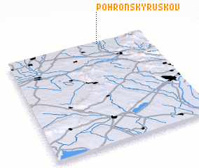 Places with similar names to Pohronský Ruskov, Slovakia :: Disclaimer :: Information on this page comes without warranty of any kind |
||
|
Where is Pohronský Ruskov? Elevation and coordinates ::
Latitude (lat): 47°59'0"N Longitude (lon): 18°40'0"E
Elevation (approx.): 128m (map arrows pan, magnifying glasses zoom) |
||
|
Visiting Pohronský Ruskov? Hotel/Accommodation ::
Book a hotel in Pohronský Ruskov Travel Guide ::
Buy a travel guide for Slovakia rental cars ::
car rental offers GPS waypoint ::
download a GPX waypoint (PoI) of Pohronský Ruskov for your GPS receiver
|
||