|
search place name
|
||
Potok (Slovakia)Potok is a town in Slovakia. An overview map of the region around Potok is displayed below.
regional and 3d topo map of Potok, Slovakia ::

Potok airports ::
The nearest airport is TAT - Poprad Tatry, located 58.1 km north of Potok.
Other airports nearby include SLD - Sliac (68.0 km west), KSC - Kosice (88.5 km east), BUD - Budapest Ferihegy (138.9 km south west), DEB - Debrecen (167.3 km south east), Nearby towns ::
Rovné (1.9km north) //
Ratkovská Suchá (2.2km north east) //
Poproč (2.2km north west) //
Lipovec (2.2km south east) //
Brádno (2.5km west) //
Striežovce (3.9km south) //
Ratkovská Zdychava (4.4km north west) //
Kyjatice (4.4km south west) //
Hrušovo (5.6km south) //
Ratkovská Lehota (3.7km east) //
Ratková (4.1km north east) //
Slizké (6.1km south east) //
Polom (5.2km north west) //
Hrlica (7.4km north) //
Sása (4.9km east) //
Ostrany (7.4km south) //
Krokava (7.5km north) //
Repištia (5.2km east) //
Babínec (6.7km south west) //
Ploské (6.7km north east) //
Sirk (6.7km north east) //
Hostišovce (8.9km south east) //
Kraskovo (8.9km south west) //
[all distances 'as the bird flies' and approximate] 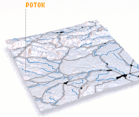 Places with similar names to Potok, Slovakia ::
Disclaimer :: Information on this page comes without warranty of any kind |
||
|
Where is Potok? Elevation and coordinates ::
Latitude (lat): 48°34'0"N Longitude (lon): 20°3'0"E
Elevation (approx.): 333m (map arrows pan, magnifying glasses zoom) |
||
|
Visiting Potok? Hotel/Accommodation ::
Book a hotel in Potok Travel Guide ::
Buy a travel guide for Slovakia rental cars ::
car rental offers GPS waypoint ::
download a GPX waypoint (PoI) of Potok for your GPS receiver
|
||