|
search place name
|
||
Pusta Paula (Slovakia)Pusta Paula is a town in Slovakia. An overview map of the region around Pusta Paula is displayed below.
regional and 3d topo map of Pusta Paula, Slovakia ::

Pusta Paula airports ::
The nearest airport is SLD - Sliac, located 65.7 km north east of Pusta Paula.
Other airports nearby include BUD - Budapest Ferihegy (82.3 km south east), PZY - Piestany (90.8 km north west), BTS - Bratislava M R Stefanik (115.9 km west), TAT - Poprad Tatry (153.5 km north east), Nearby towns ::
Pežerne (2.2km north west) //
Iľava (3.7km north) //
Ágota Majer (3.7km south) //
Demandice (3.9km north) //
Sazdice (3.1km south east) //
Santovka (5.6km north) //
Malý Pesek (3.7km west) //
Dvor Rakovského (5.6km south) //
Malinovec (5.7km north) //
Lontov (5.7km south) //
Veľký Pesek (4.2km south west) //
Hontianska Vrbica (5.2km north west) //
Trhyňa (5.2km south west) //
Kubáňovo (5.2km south east) //
Cegrit (7.5km north) //
Zbrojníky (5.3km west) //
Kukučinov (5.3km west) //
Ivanka Majer (6.2km south east) //
Jarok (8.9km south west) //
[all distances 'as the bird flies' and approximate] 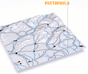 Places with similar names to Pusta Paula, Slovakia ::
// Pasta Pal (PK)
// Postupelʼ (UA)
// Pozdopal (RU)
// Pusté Pole (SK)
// Pusté Pole (SK)
// Pusté Pole (SK)
Disclaimer :: Information on this page comes without warranty of any kind |
||
|
Where is Pusta Paula? Elevation and coordinates ::
Latitude (lat): 48°6'0"N Longitude (lon): 18°46'0"E
Elevation (approx.): 193m (map arrows pan, magnifying glasses zoom) |
||
|
Visiting Pusta Paula? Hotel/Accommodation ::
Book a hotel in Pusta Paula Travel Guide ::
Buy a travel guide for Slovakia rental cars ::
car rental offers GPS waypoint ::
download a GPX waypoint (PoI) of Pusta Paula for your GPS receiver
|
||