|
search place name
|
||
Rochovce (Slovakia)Rochovce is a town in Slovakia. An overview map of the region around Rochovce is displayed below.
regional and 3d topo map of Rochovce, Slovakia ::

Rochovce airports ::
The nearest airport is TAT - Poprad Tatry, located 41.8 km north of Rochovce.
Other airports nearby include KSC - Kosice (69.4 km east), SLD - Sliac (86.2 km west), KRK - Krakow Balice (157.7 km north), BUD - Budapest Ferihegy (160.6 km south west), Nearby towns ::
Slavošovce (2.2km north west) //
Markuška (3.9km north) //
Ochtiná (3.1km south east) //
Roštár (3.7km east) //
Hanková (5.7km north) //
Koceľovce (4.1km north east) //
Kopráš (4.1km south west) //
Slavoška (5.2km north east) //
Čierna Lehota (5.2km north west) //
Petrovo (5.2km east) //
Brdárka (7.8km north) //
Mníšany (6.1km south west) //
Štítnik (6.1km south east) //
Kobeliarovo (7.4km north east) //
Gočaltovo (8.3km south east) //
Jelšava (8.9km south west) //
[all distances 'as the bird flies' and approximate] 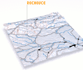 Places with similar names to Rochovce, Slovakia ::
// Hříchovice (CZ)
Disclaimer :: Information on this page comes without warranty of any kind |
||
|
Where is Rochovce? Elevation and coordinates ::
Latitude (lat): 48°42'0"N Longitude (lon): 20°18'0"E
Elevation (approx.): 370m (map arrows pan, magnifying glasses zoom) |
||
|
Visiting Rochovce? Hotel/Accommodation ::
Book a hotel in Rochovce Travel Guide ::
Buy a travel guide for Slovakia rental cars ::
car rental offers GPS waypoint ::
download a GPX waypoint (PoI) of Rochovce for your GPS receiver
|
||