|
search place name
|
||
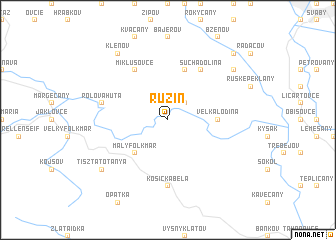
Ružín (Slovakia)Ružín is a town in Slovakia. An overview map of the region around Ružín is displayed below.
regional and 3d topo map of Ružín, Slovakia ::
Ružín airports ::
The nearest airport is KSC - Kosice, located 24.4 km south of Ružín.
Other airports nearby include TAT - Poprad Tatry (68.1 km west), SLD - Sliac (148.0 km west), RZE - Rzeszow Jasionka (153.0 km north east), DEB - Debrecen (157.6 km south), Nearby towns ::
Malá Lodina (2.2km north east) //
Košické Hámre (4.4km south west) //
Malý Folkmar (4.4km south west) //
Veľká Lodina (3.7km east) //
Sedlice (5.7km north) //
Suchá Dolina (6.1km north east) //
Miklušovce (6.1km north west) //
Košická Belá (7.4km south) //
Rolova Huta (5.2km west) //
Klenov (8.3km north west) //
ľubovec (7.4km north east) //
Tisztatótanya (7.4km south west) //
Janov (8.9km north east) //
Meretice (8.9km north east) //
[all distances 'as the bird flies' and approximate]  Places with similar names to Ružín, Slovakia ::
Disclaimer :: Information on this page comes without warranty of any kind |
||
|
Where is Ružín? Elevation and coordinates ::
Latitude (lat): 48°52'0"N Longitude (lon): 21°7'0"E
Elevation (approx.): 389m (map arrows pan, magnifying glasses zoom) |
||
|
Visiting Ružín? Hotel/Accommodation ::
Book a hotel in Ružín Travel Guide ::
Buy a travel guide for Slovakia rental cars ::
car rental offers GPS waypoint ::
download a GPX waypoint (PoI) of Ružín for your GPS receiver
|
||