|
search place name
|
||
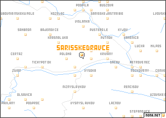
Šarišské Dravce (Slovakia)Šarišské Dravce is a town in Slovakia. An overview map of the region around Šarišské Dravce is displayed below.
regional and 3d topo map of Šarišské Dravce, Slovakia ::
Šarišské Dravce airports ::
The nearest airport is TAT - Poprad Tatry, located 46.8 km west of Šarišské Dravce.
Other airports nearby include KSC - Kosice (62.4 km south east), KRK - Krakow Balice (128.0 km north west), RZE - Rzeszow Jasionka (133.9 km north east), SLD - Sliac (140.0 km south west), Nearby towns ::
Torysa (1.2km east) //
Oľšov (2.2km north east) //
Brezovica nad Torysou (2.2km south west) //
Poloma (2.4km west) //
Vysoká (3.9km south) //
Brezovička (3.9km south) //
Krivany (3.6km east) //
Podhrádok (4.1km north east) //
Pusté Pole (6.1km north east) //
Krásna Lúka (5.2km north west) //
Putnov (5.2km north east) //
Vislanka (7.4km north) //
Ďurkov (7.4km north) //
Ďačov (5.2km east) //
Nižný Slavkov (7.5km south) //
Bajerovce (7.4km north west) //
[all distances 'as the bird flies' and approximate] 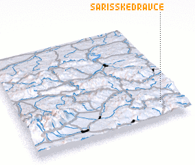 Places with similar names to Šarišské Dravce, Slovakia :: Disclaimer :: Information on this page comes without warranty of any kind |
||
|
Where is Šarišské Dravce? Elevation and coordinates ::
Latitude (lat): 49°10'0"N Longitude (lon): 20°52'0"E
Elevation (approx.): 456m (map arrows pan, magnifying glasses zoom) |
||
|
Visiting Šarišské Dravce? Hotel/Accommodation ::
Book a hotel in Šarišské Dravce Travel Guide ::
Buy a travel guide for Slovakia rental cars ::
car rental offers GPS waypoint ::
download a GPX waypoint (PoI) of Šarišské Dravce for your GPS receiver
|
||