|
search place name
|
||
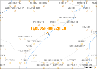
Tekovská Breznica (Slovakia)Tekovská Breznica is a town in Slovakia. An overview map of the region around Tekovská Breznica is displayed below.
regional and 3d topo map of Tekovská Breznica, Slovakia ::
Tekovská Breznica airports ::
The nearest airport is SLD - Sliac, located 47.6 km north east of Tekovská Breznica.
Other airports nearby include PZY - Piestany (64.2 km north west), BTS - Bratislava M R Stefanik (106.9 km west), BUD - Budapest Ferihegy (115.6 km south east), TAT - Poprad Tatry (142.0 km north east), Nearby towns ::
Orovnica (1.2km west) //
Brehy (3.1km north east) //
Záhrb (3.9km north) //
Stará Huta (4.4km north west) //
Bukovina (4.4km north west) //
Nemecká Huta (4.1km north west) //
Svätý Beňadik (5.2km south west) //
Nová Baňa (6.1km north east) //
Rudno nad Hronom (7.4km north east) //
Psiare (7.4km south west) //
[all distances 'as the bird flies' and approximate] 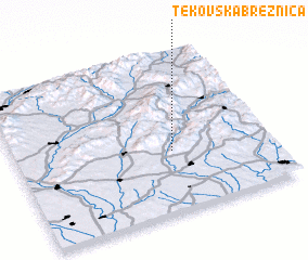 Places with similar names to Tekovská Breznica, Slovakia :: Disclaimer :: Information on this page comes without warranty of any kind |
||
|
Where is Tekovská Breznica? Elevation and coordinates ::
Latitude (lat): 48°23'0"N Longitude (lon): 18°37'0"E
Elevation (approx.): 211m (map arrows pan, magnifying glasses zoom) |
||
|
Visiting Tekovská Breznica? Hotel/Accommodation ::
Book a hotel in Tekovská Breznica Travel Guide ::
Buy a travel guide for Slovakia rental cars ::
car rental offers GPS waypoint ::
download a GPX waypoint (PoI) of Tekovská Breznica for your GPS receiver
|
||