|
search place name
|
||
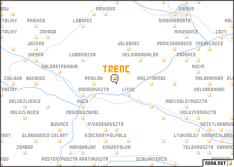
Trenč (Slovakia)Trenč is a town in Slovakia. An overview map of the region around Trenč is displayed below.
regional and 3d topo map of Trenč, Slovakia ::
Trenč airports ::
The nearest airport is SLD - Sliac, located 55.9 km north west of Trenč.
Other airports nearby include BUD - Budapest Ferihegy (91.9 km south), TAT - Poprad Tatry (105.3 km north east), KSC - Kosice (131.6 km east), PZY - Piestany (137.0 km west), Nearby towns ::
Litke (2.2km south east) //
Malé Dáľovce (2.2km north east) //
Prieloh (2.5km west) //
Rárospuszta (3.1km south west) //
Veliká nad Ipľom (4.5km north east) //
Ipolytarnóc (3.7km east) //
Hámor (4.1km south west) //
Jelšovec (5.7km north) //
Muľa (5.2km south west) //
Mihálygerge (5.2km south east) //
ľuboriečka (5.2km north west) //
Kőhegyaljapuszta (7.4km south) //
Nyergespuszta (7.5km south) //
Nógrádszakál (6.7km south west) //
Kalonda (6.2km north east) //
Mátéüléspuszta (7.4km south east) //
Egyházasgerge (7.4km south east) //
Egyházasgergei Tanya (7.4km south east) //
[all distances 'as the bird flies' and approximate]  Places with similar names to Trenč, Slovakia ::
Disclaimer :: Information on this page comes without warranty of any kind |
||
|
Where is Trenč? Elevation and coordinates ::
Latitude (lat): 48°14'0"N Longitude (lon): 19°35'0"E
Elevation (approx.): 181m (map arrows pan, magnifying glasses zoom) |
||
|
Visiting Trenč? Hotel/Accommodation ::
Book a hotel in Trenč Travel Guide ::
Buy a travel guide for Slovakia rental cars ::
car rental offers GPS waypoint ::
download a GPX waypoint (PoI) of Trenč for your GPS receiver
|
||