|
search place name
|
||
Údol (Slovakia)Údol is a town in Slovakia. An overview map of the region around Údol is displayed below.
regional and 3d topo map of Údol, Slovakia ::

Údol airports ::
The nearest airport is TAT - Poprad Tatry, located 48.9 km south west of Údol.
Other airports nearby include KSC - Kosice (77.3 km south east), KRK - Krakow Balice (114.1 km north west), RZE - Rzeszow Jasionka (125.0 km north east), SLD - Sliac (143.5 km south west), Nearby towns ::
Hajtovka (2.4km west) //
Starina (3.9km north) //
Malý Lipník (3.9km north) //
Plavnica (3.0km south west) //
Plaveč (4.4km south east) //
Legnava (4.4km north east) //
Kozelec (5.6km south) //
Andrzejówka (5.6km north) //
Hromoš (5.7km south) //
Orlov (4.1km south east) //
Matysová (4.1km north west) //
Podpíla (5.2km south east) //
Milik (6.1km north east) //
Żegiestów Zdrój (7.4km north) //
ľubotín (6.1km south east) //
Malý Sulín (7.8km north) //
Ďurkov (8.3km south east) //
Vislanka (8.3km south east) //
Veľký Sulín (8.8km north west) //
[all distances 'as the bird flies' and approximate] 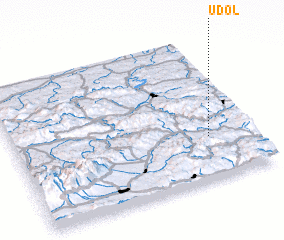 Places with similar names to Údol, Slovakia ::
Disclaimer :: Information on this page comes without warranty of any kind |
||
|
Where is Údol? Elevation and coordinates ::
Latitude (lat): 49°18'0"N Longitude (lon): 20°49'0"E
Elevation (approx.): 608m (map arrows pan, magnifying glasses zoom) |
||
|
Visiting Údol? Hotel/Accommodation ::
Book a hotel in Údol Travel Guide ::
Buy a travel guide for Slovakia rental cars ::
car rental offers GPS waypoint ::
download a GPX waypoint (PoI) of Údol for your GPS receiver
|
||