|
search place name
|
||
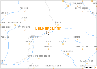
Veľká Poľana (Slovakia)Veľká Poľana is a town in Slovakia. An overview map of the region around Veľká Poľana is displayed below.
regional and 3d topo map of Veľká Poľana, Slovakia ::
Veľká Poľana airports ::
The nearest airport is KSC - Kosice, located 91.7 km south west of Veľká Poľana.
Other airports nearby include RZE - Rzeszow Jasionka (116.2 km north), LWO - Lvov Lviv Intl (143.9 km north east), SUJ - Satu Mare (159.1 km south), BAY - Baia Mare Tautii Magheraus (180.0 km south east), Nearby towns ::
 Places with similar names to Veľká Poľana, Slovakia ::
Disclaimer :: Information on this page comes without warranty of any kind |
||
|
Where is Veľká Poľana? Elevation and coordinates ::
Latitude (lat): 49°5'0"N Longitude (lon): 22°19'0"E
Elevation (approx.): 632m (map arrows pan, magnifying glasses zoom) |
||
|
Visiting Veľká Poľana? Hotel/Accommodation ::
Book a hotel in Veľká Poľana Travel Guide ::
Buy a travel guide for Slovakia rental cars ::
car rental offers GPS waypoint ::
download a GPX waypoint (PoI) of Veľká Poľana for your GPS receiver
|
||