|
search place name
|
||
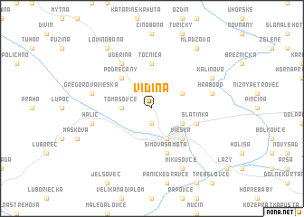
Vidiná (Slovakia)Vidiná is a town in Slovakia. An overview map of the region around Vidiná is displayed below.
regional and 3d topo map of Vidiná, Slovakia ::
Vidiná airports ::
The nearest airport is SLD - Sliac, located 48.6 km north west of Vidiná.
Other airports nearby include TAT - Poprad Tatry (89.8 km north east), BUD - Budapest Ferihegy (107.5 km south), KSC - Kosice (122.1 km east), PZY - Piestany (137.7 km west), Nearby towns ::
Tauszova Samota (1.9km south) //
Tomášovce (2.5km west) //
Veľká Ves (3.1km north east) //
Pronayovská (3.1km south east) //
Lučenec (3.9km south) //
Podrečany (4.4km north west) //
Vieska (4.5km south east) //
Opatová (4.5km south east) //
Točnica (5.6km north) //
Slatinka (4.1km south east) //
Šimova Samota (5.7km south) //
Uderiná (6.1km north west) //
Gregorova Vieska (5.3km west) //
Hrabovo (5.3km east) //
Halič (5.3km west) //
Kalinovo (6.2km north east) //
Mikušovce (7.8km south) //
Lovinobaňa (8.3km north west) //
Mládzovo (8.3km north east) //
[all distances 'as the bird flies' and approximate]  Places with similar names to Vidiná, Slovakia ::
Disclaimer :: Information on this page comes without warranty of any kind |
||
|
Where is Vidiná? Elevation and coordinates ::
Latitude (lat): 48°22'0"N Longitude (lon): 19°39'0"E
Elevation (approx.): 209m (map arrows pan, magnifying glasses zoom) |
||
|
Visiting Vidiná? Hotel/Accommodation ::
Book a hotel in Vidiná Travel Guide ::
Buy a travel guide for Slovakia rental cars ::
car rental offers GPS waypoint ::
download a GPX waypoint (PoI) of Vidiná for your GPS receiver
|
||