|
search place name
|
||
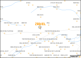
Zádiel (Slovakia)Zádiel is a town in Slovakia. An overview map of the region around Zádiel is displayed below.
regional and 3d topo map of Zádiel, Slovakia ::
Zádiel airports ::
The nearest airport is KSC - Kosice, located 30.5 km east of Zádiel.
Other airports nearby include TAT - Poprad Tatry (66.9 km north west), SLD - Sliac (125.3 km west), DEB - Debrecen (138.3 km south east), BUD - Budapest Ferihegy (176.2 km south west), Nearby towns ::
Dvorníky (1.9km south) //
Háj (3.1km north east) //
Včeláre (3.9km south) //
Gyu”rmajor (3.1km south east) //
Hačava (5.6km north) //
Turna nad Bodvou (4.1km south east) //
Hidvégardó (5.7km south) //
Hosťovce nad Bodvou (6.1km south east) //
Borka (5.2km west) //
Bódvalenke (7.5km south) //
Tornanádaska (6.7km south west) //
Chorváty (6.7km south east) //
Turnianska Nová Ves (6.1km south east) //
Malompart (8.9km south west) //
Komjáti (8.9km south west) //
Katalinmajor (8.9km south east) //
[all distances 'as the bird flies' and approximate]  Places with similar names to Zádiel, Slovakia ::
Disclaimer :: Information on this page comes without warranty of any kind |
||
|
Where is Zádiel? Elevation and coordinates ::
Latitude (lat): 48°37'0"N Longitude (lon): 20°50'0"E
Elevation (approx.): 290m (map arrows pan, magnifying glasses zoom) |
||
|
Visiting Zádiel? Hotel/Accommodation ::
Book a hotel in Zádiel Travel Guide ::
Buy a travel guide for Slovakia rental cars ::
car rental offers GPS waypoint ::
download a GPX waypoint (PoI) of Zádiel for your GPS receiver
|
||