|
search place name
|
||
Bdín (Czech Republic)Bdín is a town in Czech Republic. An overview map of the region around Bdín is displayed below.
regional and 3d topo map of Bdín, Czech Republic ::

Bdín airports ::
The nearest airport is PRG - Prague Ruzyne, located 30.9 km south east of Bdín.
Other airports nearby include KLV - Karlovy Vary (68.0 km west), DRS - Dresden (102.2 km north), BBJ - Bautzen (118.1 km north east), AOC - Altenburg Nobitz (128.5 km north west), Nearby towns ::
Milý (1.9km north) //
Srbeč (2.2km north east) //
Bor (3.7km north) //
Třtice (3.7km south) //
Dučice (2.4km west) //
Přerubenice (2.4km west) //
Kalivody (3.0km south west) //
Mšec (4.0km south east) //
Hvížďalka (5.7km north) //
Kozojedy (5.1km north west) //
Mšecké Žehrovice (5.1km south east) //
Vinařice (6.0km north west) //
Hřešice (5.1km east) //
Nová Ves (7.5km north) //
Pochvalov (5.1km west) //
Bílichov (6.6km north east) //
Líský (6.0km north east) //
Smilovice (6.0km north west) //
Řevničov (6.0km south west) //
Zichovec (7.3km north east) //
Divice (8.2km north west) //
Žerotín (8.2km north east) //
Nové Strašecí (8.2km south east) //
Úlovice (7.3km north west) //
[all distances 'as the bird flies' and approximate] 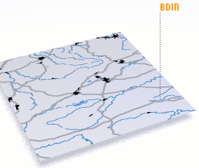 Places with similar names to Bdín, Czech Republic ::
Disclaimer :: Information on this page comes without warranty of any kind |
||
|
Where is Bdín? Elevation and coordinates ::
Latitude (lat): 50°13'0"N Longitude (lon): 13°52'0"E
Elevation (approx.): 406m (map arrows pan, magnifying glasses zoom) |
||
|
Visiting Bdín? Hotel/Accommodation ::
Book a hotel in Bdín Travel Guide ::
rental cars ::
car rental offers GPS waypoint ::
download a GPX waypoint (PoI) of Bdín for your GPS receiver
|
||