|
search place name
|
||
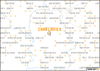
Chmelovice (Czech Republic)Chmelovice is a town in Czech Republic. An overview map of the region around Chmelovice is displayed below.
regional and 3d topo map of Chmelovice, Czech Republic ::
Chmelovice airports ::
The nearest airport is PED - Pardubice, located 32.4 km south of Chmelovice.
Other airports nearby include PRG - Prague Ruzyne (95.5 km west), BBJ - Bautzen (125.4 km north west), WRO - Wroclaw Strachowice (130.4 km north east), BRQ - Turany (149.9 km south east), Nearby towns ::
Myštěves (1.9km north) //
Podoliby (1.2km west) //
Janatov (2.2km south east) //
Kanice (2.2km north east) //
Blažkov (2.2km north west) //
Petrovice (2.5km east) //
Opatov (3.9km south) //
Kobylice (3.9km south) //
Petrovičky (3.0km north east) //
Králíky (3.0km south west) //
Šaplava (4.4km north west) //
Sukorady (5.7km north) //
Lodín (4.0km south east) //
Pšánky (4.0km north east) //
Lískovice (5.7km north) //
Prasek (5.7km south) //
Bašnice (6.0km north east) //
Staré Nechanice (5.1km south east) //
Bříšťany (5.1km north east) //
Tereziny Dary (6.0km north west) //
Libeň (6.0km south west) //
Nerošov (4.7km east) //
Zdechovice (7.4km south) //
Suchá (5.1km east) //
Stračov (5.1km east) //
Barchŭvek (7.5km south) //
Skřivany (5.1km west) //
Sloupno (5.1km west) //
Sylvárŭv Újezd (7.5km north) //
[all distances 'as the bird flies' and approximate]  Places with similar names to Chmelovice, Czech Republic :: Disclaimer :: Information on this page comes without warranty of any kind |
||
|
Where is Chmelovice? Elevation and coordinates ::
Latitude (lat): 50°17'0"N Longitude (lon): 15°34'0"E
Elevation (approx.): 247m (map arrows pan, magnifying glasses zoom) |
||
|
Visiting Chmelovice? Hotel/Accommodation ::
Book a hotel in Chmelovice Travel Guide ::
rental cars ::
car rental offers GPS waypoint ::
download a GPX waypoint (PoI) of Chmelovice for your GPS receiver
|
||