|
search place name
|
||
Chvalnov (Czech Republic)Chvalnov is a town in Czech Republic. An overview map of the region around Chvalnov is displayed below.
regional and 3d topo map of Chvalnov, Czech Republic ::

Chvalnov airports ::
The nearest airport is PRV - Prerov, located 31.4 km north east of Chvalnov.
Other airports nearby include BRQ - Turany (39.3 km west), PZY - Piestany (74.4 km south east), OSR - Ostrava Mosnov (86.7 km north east), BTS - Bratislava M R Stefanik (110.8 km south), Nearby towns ::
Strabenice (1.9km north) //
Zástřizly (1.9km south) //
Střílky (2.2km south west) //
Lísky (2.4km west) //
Cetechovice (2.4km east) //
Honětice (3.9km north) //
Litenčice (4.4km north west) //
Hoštice (5.6km north) //
Roštín (4.1km north east) //
Kunkovice (4.1km north west) //
Stupava (5.7km south) //
Kožušice (4.1km south west) //
Zdislavice (6.1km north east) //
Staré Hutě (5.2km south east) //
Koryčany (6.6km south west) //
Lískovec (6.6km south west) //
Troubky (7.8km north) //
Blišice (7.4km south west) //
Nítkovice (7.4km north west) //
Lebedov (7.4km north east) //
Těšánky (7.4km north east) //
[all distances 'as the bird flies' and approximate] 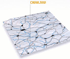 Places with similar names to Chvalnov, Czech Republic :: Disclaimer :: Information on this page comes without warranty of any kind |
||
|
Where is Chvalnov? Elevation and coordinates ::
Latitude (lat): 49°10'0"N Longitude (lon): 17°14'0"E
Elevation (approx.): 308m (map arrows pan, magnifying glasses zoom) |
||
|
Visiting Chvalnov? Hotel/Accommodation ::
Book a hotel in Chvalnov Travel Guide ::
rental cars ::
car rental offers GPS waypoint ::
download a GPX waypoint (PoI) of Chvalnov for your GPS receiver
|
||