|
search place name
|
||
Hostětice (Czech Republic)Hostětice is a town in Czech Republic. An overview map of the region around Hostětice is displayed below.
regional and 3d topo map of Hostětice, Czech Republic ::

Hostětice airports ::
The nearest airport is BRQ - Turany, located 93.3 km east of Hostětice.
Other airports nearby include PED - Pardubice (93.4 km north), PRG - Prague Ruzyne (130.4 km north west), LNZ - Linz (Horsching) (140.5 km south west), PRV - Prerov (146.7 km east), Nearby towns ::
Vanov (1.9km north) //
Vanŭvek (1.9km north) //
Částkovice (1.2km west) //
Krahulčí (1.9km south) //
Horní Myslová (3.7km south) //
Doupě (3.9km north) //
Řídelov (3.9km north) //
Volevčice (3.0km north east) //
Studnice (3.0km north east) //
Borovná (3.9km south) //
Řásná (3.0km north west) //
Lhotka (3.0km north west) //
Mrákotín (3.1km south west) //
Dobrá Voda (3.1km south west) //
Kostelní Myslová (5.6km south) //
Telč (4.1km south east) //
Třeštice (6.1km north east) //
Mysletice (6.1km south west) //
Olší (6.1km south west) //
Zadní Vydří (7.4km south) //
Mysliboř (5.2km east) //
Rŭžená (7.5km north) //
Praskolesy (5.2km west) //
Radkov (6.6km south east) //
Myslŭvka (7.8km south) //
Lipová (7.8km south) //
Černíč (8.3km south east) //
Slaviboř (8.3km south east) //
Řečice (8.3km south west) //
[all distances 'as the bird flies' and approximate] 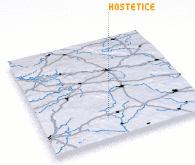 Places with similar names to Hostětice, Czech Republic :: Disclaimer :: Information on this page comes without warranty of any kind |
||
|
Where is Hostětice? Elevation and coordinates ::
Latitude (lat): 49°12'0"N Longitude (lon): 15°25'0"E
Elevation (approx.): 602m (map arrows pan, magnifying glasses zoom) |
||
|
Visiting Hostětice? Hotel/Accommodation ::
Book a hotel in Hostětice Travel Guide ::
rental cars ::
car rental offers GPS waypoint ::
download a GPX waypoint (PoI) of Hostětice for your GPS receiver
|
||