|
search place name
|
||
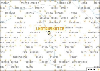
Lhota u Skutče (Czech Republic)Lhota u Skutče is a town in Czech Republic. An overview map of the region around Lhota u Skutče is displayed below.
regional and 3d topo map of Lhota u Skutče, Czech Republic ::
Lhota u Skutče airports ::
The nearest airport is PED - Pardubice, located 27.7 km north west of Lhota u Skutče.
Other airports nearby include BRQ - Turany (92.2 km south east), PRV - Prerov (109.4 km south east), PRG - Prague Ruzyne (131.0 km west), WRO - Wroclaw Strachowice (149.7 km north east), Nearby towns ::
Doly (0.0km north) //
Brdo (1.2km east) //
Zhoř (1.9km south) //
Bílý Kŭň (2.2km north east) //
Košumberk (2.2km north west) //
Zdislav (2.2km north west) //
Hluboká (2.2km south east) //
Borek (2.2km south east) //
Zbožnov (2.2km south west) //
Chlum (2.4km east) //
Hněvětice (3.7km south) //
Podhradí (3.7km south) //
Střemošice (3.9km north) //
Luže (3.9km north) //
Radim (4.4km north west) //
Perálec (4.4km south east) //
Lažany (4.4km south west) //
Srbce (5.6km north) //
Nová Ves (3.6km west) //
Štěpánov (3.6km west) //
Doubravice (4.0km north east) //
Hroubovice (4.0km north west) //
Pěšice (5.7km north) //
Voletice (5.7km north) //
Střítež (4.0km south east) //
Skuteč (4.0km south west) //
Kutřín (5.7km south) //
Lešany (5.7km south) //
Řepníky (6.1km north east) //
[all distances 'as the bird flies' and approximate] 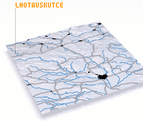 Places with similar names to Lhota u Skutče, Czech Republic :: Disclaimer :: Information on this page comes without warranty of any kind |
||
|
Where is Lhota u Skutče? Elevation and coordinates ::
Latitude (lat): 49°52'0"N Longitude (lon): 16°3'0"E
Elevation (approx.): 343m (map arrows pan, magnifying glasses zoom) |
||
|
Visiting Lhota u Skutče? Hotel/Accommodation ::
Book a hotel in Lhota u Skutče Travel Guide ::
rental cars ::
car rental offers GPS waypoint ::
download a GPX waypoint (PoI) of Lhota u Skutče for your GPS receiver
|
||