|
search place name
|
||
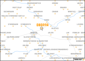
Oborná (Czech Republic)Oborná is a town in Czech Republic. An overview map of the region around Oborná is displayed below.
regional and 3d topo map of Oborná, Czech Republic ::
Oborná airports ::
The nearest airport is OSR - Ostrava Mosnov, located 55.4 km south east of Oborná.
Other airports nearby include PRV - Prerov (64.2 km south), BRQ - Turany (110.9 km south west), KTW - Katowice Pyrzowice (124.5 km north east), PED - Pardubice (126.3 km west), Nearby towns ::
Bruntál (3.0km south west) //
Jelení (3.0km south east) //
Nové Heřmínovy (3.0km north east) //
Kunov (3.9km north) //
Dlouhá Stráň (5.6km south) //
Milotice (3.6km east) //
Mezina (5.7km south) //
Skrbovice (5.7km north) //
Markvartice (6.0km north west) //
Slezský Kočov (5.1km south west) //
Karlovec (7.4km south) //
Široká Niva (7.5km north) //
Staré Město (5.1km west) //
Moravský Kočov (6.6km south west) //
Dětřichovice (7.3km north west) //
Čaková (8.2km north east) //
Valšov (8.8km south west) //
[all distances 'as the bird flies' and approximate] 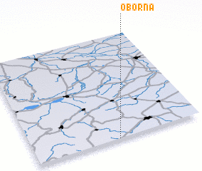 Places with similar names to Oborná, Czech Republic ::
Disclaimer :: Information on this page comes without warranty of any kind |
||
|
Where is Oborná? Elevation and coordinates ::
Latitude (lat): 50°0'0"N Longitude (lon): 17°30'0"E
Elevation (approx.): 527m (map arrows pan, magnifying glasses zoom) |
||
|
Visiting Oborná? Hotel/Accommodation ::
Book a hotel in Oborná Travel Guide ::
rental cars ::
car rental offers GPS waypoint ::
download a GPX waypoint (PoI) of Oborná for your GPS receiver
|
||