|
search place name
|
||
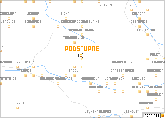
Podstupně (Czech Republic)Podstupně is a town in Czech Republic. An overview map of the region around Podstupně is displayed below.
regional and 3d topo map of Podstupně, Czech Republic ::
Podstupně airports ::
The nearest airport is OSR - Ostrava Mosnov, located 26.2 km north west of Podstupně.
Other airports nearby include PRV - Prerov (62.8 km west), PZY - Piestany (100.7 km south), SLD - Sliac (113.4 km south east), BRQ - Turany (120.1 km west), Nearby towns ::
Pustevně (0.0km north) //
Na Skále (1.9km south) //
Búřov (2.2km south west) //
Bácov (3.9km south) //
Trojanovice (3.9km north) //
Prostřední Bečva (4.4km south west) //
Dvŭr Kostelník (5.6km north) //
Horní Bečva (5.7km south) //
Kunčice pod Ondřejníkem (7.4km north) //
Mohyla (5.2km east) //
Hutisko (6.6km south west) //
Solanec pod Soláněm (6.6km south west) //
Na Mirčici (6.6km south east) //
V Buckovém (7.8km south) //
V Ondrových (7.4km south east) //
Frenštát pod Radhoštěm (8.2km north west) //
Msadla (8.8km south east) //
[all distances 'as the bird flies' and approximate] 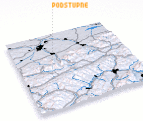 Places with similar names to Podstupně, Czech Republic ::
Disclaimer :: Information on this page comes without warranty of any kind |
||
|
Where is Podstupně? Elevation and coordinates ::
Latitude (lat): 49°29'0"N Longitude (lon): 18°16'0"E
Elevation (approx.): 912m (map arrows pan, magnifying glasses zoom) |
||
|
Visiting Podstupně? Hotel/Accommodation ::
Book a hotel in Podstupně Travel Guide ::
rental cars ::
car rental offers GPS waypoint ::
download a GPX waypoint (PoI) of Podstupně for your GPS receiver
|
||