|
search place name
|
||
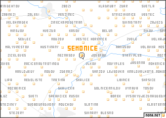
Semonice (Czech Republic)Semonice is a town in Czech Republic. An overview map of the region around Semonice is displayed below.
regional and 3d topo map of Semonice, Czech Republic ::
Semonice airports ::
The nearest airport is PED - Pardubice, located 37.1 km south of Semonice.
Other airports nearby include WRO - Wroclaw Strachowice (111.1 km north east), PRG - Prague Ruzyne (118.7 km west), BBJ - Bautzen (135.7 km north west), BRQ - Turany (143.9 km south east), Nearby towns ::
Černožice (1.9km south) //
Rožnov (1.2km west) //
Jezbiny (1.2km east) //
Vlkov (2.2km south east) //
Neznášov (2.4km west) //
Josefov (2.4km east) //
Rtyně (3.7km north) //
Vestec (3.7km north) //
Smiřice (3.9km south) //
Holohlavy (3.9km south) //
Hubíles (3.9km south) //
Rasošky (3.0km south east) //
Jaroměř (3.2km north east) //
Zderaz (4.4km south west) //
Smržov (4.4km south east) //
Hořenice (4.4km north east) //
Velichovky (3.9km north west) //
Skalice (5.6km south) //
Zaloňov (5.6km north) //
Habřina (3.5km west) //
Kašov (5.7km north) //
Číbuz (5.7km south) //
Újezd (5.7km south) //
Litíč (6.0km north west) //
Brod (6.0km north east) //
Heřmanice nad Labem (6.0km north east) //
Nouzov (5.1km north west) //
Bukovina (7.4km south) //
Hustířany (5.1km west) //
[all distances 'as the bird flies' and approximate]  Places with similar names to Semonice, Czech Republic ::
// Simmons (US)
// Simons (US)
// Samonás (GR)
// Smines (NO)
// Sømnes (NO)
// Siemianice (PL)
// Siemienice (PL)
// Siemnice (PL)
// Ziemnice (PL)
// Zimnice (PL)
Disclaimer :: Information on this page comes without warranty of any kind |
||
|
Where is Semonice? Elevation and coordinates ::
Latitude (lat): 50°20'0"N Longitude (lon): 15°53'0"E
Elevation (approx.): 258m (map arrows pan, magnifying glasses zoom) |
||
|
Visiting Semonice? Hotel/Accommodation ::
Book a hotel in Semonice Travel Guide ::
rental cars ::
car rental offers GPS waypoint ::
download a GPX waypoint (PoI) of Semonice for your GPS receiver
|
||