|
search place name
|
||
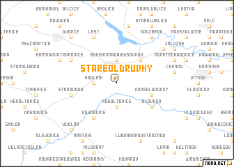
Staré Oldřŭvky (Czech Republic)Staré Oldřŭvky is a town in Czech Republic. An overview map of the region around Staré Oldřŭvky is displayed below.
regional and 3d topo map of Staré Oldřŭvky, Czech Republic ::
Staré Oldřŭvky airports ::
The nearest airport is OSR - Ostrava Mosnov, located 35.3 km east of Staré Oldřŭvky.
Other airports nearby include PRV - Prerov (41.4 km south west), BRQ - Turany (96.5 km south west), PZY - Piestany (127.7 km south), KTW - Katowice Pyrzowice (130.0 km north east), Nearby towns ::
Budišov nad Budišovkou (3.7km north) //
Podlesí (2.4km west) //
Rudoltovice (3.7km south) //
Svatoňovice (4.4km north east) //
Nové Oldřŭvky (4.0km south east) //
Vojnovice (6.1km south west) //
Olověná (5.2km south east) //
Stará Voda (5.1km west) //
Lesy (7.8km north) //
Dolní Guntramovice (6.1km north west) //
Kružberk (8.2km north east) //
Staré Těchanovice (7.3km north east) //
Dvorce (8.8km north west) //
Údolná (8.8km south west) //
[all distances 'as the bird flies' and approximate] 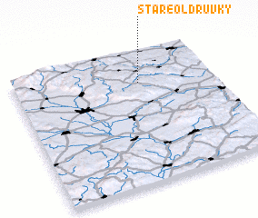 Places with similar names to Staré Oldřŭvky, Czech Republic :: Disclaimer :: Information on this page comes without warranty of any kind |
||
|
Where is Staré Oldřŭvky? Elevation and coordinates ::
Latitude (lat): 49°46'0"N Longitude (lon): 17°38'0"E
Elevation (approx.): 525m (map arrows pan, magnifying glasses zoom) |
||
|
Visiting Staré Oldřŭvky? Hotel/Accommodation ::
Book a hotel in Staré Oldřŭvky Travel Guide ::
rental cars ::
car rental offers GPS waypoint ::
download a GPX waypoint (PoI) of Staré Oldřŭvky for your GPS receiver
|
||