|
search place name
|
||
Svobodín (Czech Republic)Svobodín is a town in Czech Republic. An overview map of the region around Svobodín is displayed below.
regional and 3d topo map of Svobodín, Czech Republic ::

Svobodín airports ::
The nearest airport is PRV - Prerov, located 68.6 km south of Svobodín.
Other airports nearby include OSR - Ostrava Mosnov (78.8 km south east), PED - Pardubice (100.0 km west), BRQ - Turany (101.3 km south), WRO - Wroclaw Strachowice (122.1 km north), Nearby towns ::
Klepáčov (1.2km east) //
Vernířovice (2.2km north west) //
Sobotín (2.4km west) //
Filipová (4.4km north west) //
Rudoltice (4.4km south west) //
Štětínov (3.6km west) //
Maršikov (4.0km north west) //
Loučná nad Desnou (6.0km north west) //
Hraběšice (5.1km south west) //
Kociánov (7.8km north) //
Bukovice (7.3km north west) //
Krásné (7.3km south west) //
Milostovice (8.2km south west) //
[all distances 'as the bird flies' and approximate] 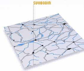 Places with similar names to Svobodín, Czech Republic ::
Disclaimer :: Information on this page comes without warranty of any kind |
||
|
Where is Svobodín? Elevation and coordinates ::
Latitude (lat): 50°1'0"N Longitude (lon): 17°8'0"E
Elevation (approx.): 754m (map arrows pan, magnifying glasses zoom) |
||
|
Visiting Svobodín? Hotel/Accommodation ::
Book a hotel in Svobodín Travel Guide ::
rental cars ::
car rental offers GPS waypoint ::
download a GPX waypoint (PoI) of Svobodín for your GPS receiver
|
||