|
search place name
|
||
Třebenice (Czech Republic)Třebenice is a town in Czech Republic. An overview map of the region around Třebenice is displayed below.
regional and 3d topo map of Třebenice, Czech Republic ::

Třebenice airports ::
The nearest airport is PRG - Prague Ruzyne, located 32.2 km north west of Třebenice.
Other airports nearby include PED - Pardubice (95.8 km east), KLV - Karlovy Vary (116.3 km west), BBJ - Bautzen (151.4 km north), DRS - Dresden (152.1 km north), Nearby towns ::
Rabyně (1.9km south) //
Přestavlky (2.2km south west) //
Teletín (2.4km east) //
Slapy (3.0km south west) //
Brunšov (3.0km north west) //
Štěchovice (3.0km north west) //
Hradišťko (3.9km north) //
Třebsín (3.0km north east) //
Loutí (4.4km south east) //
Šlemín (4.4km north west) //
Nedvězí (4.4km south east) //
Luka (4.4km north east) //
Petrov (5.6km north) //
Píkovice (5.6km north) //
Měřín (5.6km south) //
Moraň (5.7km south) //
Větrov (4.0km south east) //
Vysoký Újezd (4.0km south east) //
Jablonná (5.7km south) //
Masečín (4.0km north west) //
Krňany (4.0km north east) //
Davle (6.1km north west) //
Sázava (6.1km north west) //
Buš (5.2km south west) //
Blaženice (6.1km south east) //
Bohuliby (6.1km north east) //
Nebřich (7.4km south) //
Lahovska (4.8km west) //
Porostliny (5.1km west) //
[all distances 'as the bird flies' and approximate] 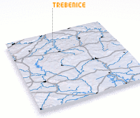 Places with similar names to Třebenice, Czech Republic ::
// Trübensee (AT)
// Trebanz (DE)
// Drobnice (PL)
// Tribonys (LT)
// Trybance (LT)
// Drobnići (BA)
// Traibuenas (ES)
// Tribunas (CO)
// Drabonso (GH)
// Dar Ben Zaou (MA)
Disclaimer :: Information on this page comes without warranty of any kind |
||
|
Where is Třebenice? Elevation and coordinates ::
Latitude (lat): 49°50'0"N Longitude (lon): 14°26'0"E
Elevation (approx.): 392m (map arrows pan, magnifying glasses zoom) |
||
|
Visiting Třebenice? Hotel/Accommodation ::
Book a hotel in Třebenice Travel Guide ::
rental cars ::
car rental offers GPS waypoint ::
download a GPX waypoint (PoI) of Třebenice for your GPS receiver
|
||