|
search place name
|
||
Třebom (Czech Republic)Třebom is a town in Czech Republic. An overview map of the region around Třebom is displayed below.
regional and 3d topo map of Třebom, Czech Republic ::

Třebom airports ::
The nearest airport is OSR - Ostrava Mosnov, located 39.7 km south of Třebom.
Other airports nearby include PRV - Prerov (82.9 km south west), KTW - Katowice Pyrzowice (88.3 km north east), KRK - Krakow Balice (125.4 km east), BRQ - Turany (139.1 km south west), Nearby towns ::
Kietrz (4.4km north west) //
Hněvošice (5.7km south) //
Sudice (4.0km south east) //
Rohov (5.1km south east) //
Pietrowice Wielkie (5.1km north east) //
Dzierżysław (4.8km west) //
Vrbka (7.5km south) //
Kobeřice (7.5km south) //
Služovice (7.8km south) //
Strahovice (7.3km south east) //
Oldřišov (8.8km south west) //
[all distances 'as the bird flies' and approximate] 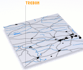 Places with similar names to Třebom, Czech Republic ::
// Dorbaum (DE)
// Tribohm (DE)
// Douar Bou Maa (TN)
// Trebuom (GH)
// Trebuom (GH)
// Taribamba (PE)
// Trou Bamby (HT)
// Tierra Bomba (CO)
Disclaimer :: Information on this page comes without warranty of any kind |
||
|
Where is Třebom? Elevation and coordinates ::
Latitude (lat): 50°3'0"N Longitude (lon): 18°2'0"E
Elevation (approx.): 223m (map arrows pan, magnifying glasses zoom) |
||
|
Visiting Třebom? Hotel/Accommodation ::
Book a hotel in Třebom Travel Guide ::
rental cars ::
car rental offers GPS waypoint ::
download a GPX waypoint (PoI) of Třebom for your GPS receiver
|
||