|
search place name
|
||
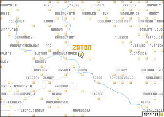
Zátoň (Czech Republic)Zátoň is a town in Czech Republic. An overview map of the region around Zátoň is displayed below.
regional and 3d topo map of Zátoň, Czech Republic ::
Zátoň airports ::
The nearest airport is LNZ - Linz (Horsching), located 84.7 km south of Zátoň.
Other airports nearby include PRG - Prague Ruzyne (132.3 km north), SZG - Salzburg (141.5 km south west), KLV - Karlovy Vary (153.4 km north west), PED - Pardubice (183.6 km north east), Nearby towns ::
Kaplice (1.2km east) //
Houžna (2.2km south west) //
Horní Vltavice (2.4km west) //
Lenora (3.7km south) //
Karbova Huť (4.4km north west) //
Řasnice (4.4km south west) //
Maschko (4.1km north west) //
Arnoštka (6.1km north west) //
Dobrá (6.1km south east) //
České Žleby (7.4km south) //
Račí (5.2km west) //
Šerava (6.7km north west) //
Korkusova Huť (7.8km north) //
Brixŭv Dvŭr (6.1km south east) //
Radvanovice (7.8km south) //
Siplŭv Dvŭr (7.4km south east) //
Žlíbky (7.4km south west) //
Včelná pod Boubínem (8.9km north east) //
Lipka (8.9km north west) //
Schnellenzipf (8.9km south west) //
[all distances 'as the bird flies' and approximate]  Places with similar names to Zátoň, Czech Republic ::
Disclaimer :: Information on this page comes without warranty of any kind |
||
|
Where is Zátoň? Elevation and coordinates ::
Latitude (lat): 48°57'0"N Longitude (lon): 13°48'0"E
Elevation (approx.): 933m (map arrows pan, magnifying glasses zoom) |
||
|
Visiting Zátoň? Hotel/Accommodation ::
Book a hotel in Zátoň Travel Guide ::
rental cars ::
car rental offers GPS waypoint ::
download a GPX waypoint (PoI) of Zátoň for your GPS receiver
|
||