|
search place name
|
||
Agerskov (Viborg, Denmark)Agerskov is a town in the Viborg region of Denmark. An overview map of the region around Agerskov is displayed below.
regional and 3d topo map of Agerskov, Denmark ::

Agerskov airports ::
The nearest airport is KRP - Karup, located 17.8 km south west of Agerskov.
Other airports nearby include BLL - Billund (76.0 km south), STA - Stauning (76.3 km south west), AAR - Aarhus (81.5 km east), TED - Thisted (81.7 km north west), Nearby towns ::
Gårsdal (1.9km north) //
Finderup (1.0km west) //
Stanghede (3.7km south) //
Ravnstrup (3.8km north) //
Jegstrup (5.6km north) //
Dollerup (5.6km south) //
Testrup (5.7km south) //
Skelhøje (5.7km south) //
Hald Ege (3.6km south east) //
Nonmølle (3.6km south east) //
Bækkelund (5.9km south) //
Fallesgårde (5.9km south) //
Romlund (7.4km north) //
Kirkebæk (7.7km north) //
Vranum (5.5km south east) //
Lysgård (7.7km south) //
Katballe (8.0km south east) //
Frederiks (8.5km south west) //
[all distances 'as the bird flies' and approximate] 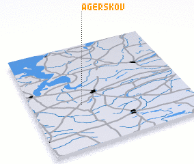 Places with similar names to Agerskov, Denmark ::
// Agerskov (DK)
Disclaimer :: Information on this page comes without warranty of any kind |
||
|
Where is Agerskov? Elevation and coordinates ::
Latitude (lat): 56°25'0"N Longitude (lon): 9°19'0"E
Elevation (approx.): 55m (map arrows pan, magnifying glasses zoom) |
||
|
Visiting Agerskov? Hotel/Accommodation ::
Book a hotel in Agerskov Travel Guide ::
Buy a travel guide for Denmark rental cars ::
car rental offers GPS waypoint ::
download a GPX waypoint (PoI) of Agerskov for your GPS receiver
|
||