|
search place name
|
||
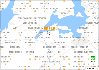
Herslev (Roskilde, Denmark)Herslev is a town in the Roskilde region of Denmark. An overview map of the region around Herslev is displayed below.
regional and 3d topo map of Herslev, Denmark ::
Herslev airports ::
The nearest airport is RKE - Copenhagen Roskilde, located 13.0 km south east of Herslev.
Other airports nearby include CPH - Copenhagen Kastrup (42.7 km east), JLD - Landskrona (63.6 km north east), MMX - Malmoe Sturup (88.8 km east), ODE - Odense (106.4 km west), Nearby towns ::
Gevninge (2.1km south west) //
Trællerup (2.1km south west) //
Kattinge (2.1km south east) //
Lyndby (2.1km west) //
Kornerup (3.7km south) //
Sæby (4.3km north west) //
Svogerslev (4.3km south east) //
Gershøj (5.6km north) //
Blæsenborg (5.6km south) //
Gammel Lejre (5.6km south) //
Lille Karleby (3.6km north west) //
Holtensminde (5.9km north) //
Allerslev (7.4km south) //
Lejre (7.4km south) //
Uglestrup (4.6km south west) //
Højby (7.5km south) //
Glim (6.4km south east) //
Biltris (6.4km north west) //
Store Karleby (5.6km north west) //
Kirke-Hyllinge (5.6km north west) //
Abbetved (5.6km south west) //
Øm (7.7km south) //
Sønderby (8.0km north east) //
Kisserup (8.5km south west) //
[all distances 'as the bird flies' and approximate] 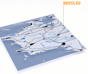 Places with similar names to Herslev, Denmark ::
Disclaimer :: Information on this page comes without warranty of any kind |
||
|
Where is Herslev? Elevation and coordinates ::
Latitude (lat): 55°40'0"N Longitude (lon): 11°59'0"E
Elevation (approx.): 4m (map arrows pan, magnifying glasses zoom) |
||
|
Visiting Herslev? Hotel/Accommodation ::
Book a hotel in Herslev Travel Guide ::
Buy a travel guide for Denmark rental cars ::
car rental offers GPS waypoint ::
download a GPX waypoint (PoI) of Herslev for your GPS receiver
|
||