|
search place name
|
||
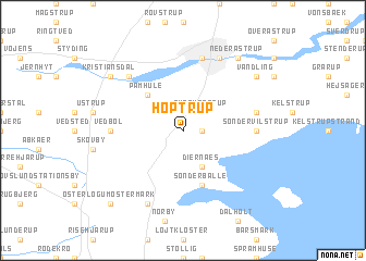
Hoptrup (Sønderjylland, Denmark)Hoptrup is a town in the Sønderjylland region of Denmark. An overview map of the region around Hoptrup is displayed below.
regional and 3d topo map of Hoptrup, Denmark ::
Hoptrup airports ::
The nearest airport is SKS - Skrydstrup, located 13.7 km west of Hoptrup.
Other airports nearby include SGD - Soenderborg Sonderborg (32.0 km south east), ODE - Odense (63.8 km north east), BLL - Billund (65.1 km north), EBJ - Esbjerg (69.4 km north west), Nearby towns ::
Neder Kestrup (1.1km east) //
Over Kestrup (2.1km north east) //
Marstrup (2.1km north west) //
Diernæs (3.9km south) //
Pamhule (4.3km north west) //
Sønderballe (5.7km south) //
Sønder Vilstrup (4.2km east) //
Vedbøl (4.2km west) //
Nørre Vilstrup (4.6km north east) //
Erlev (7.5km north) //
Fredsted (6.4km north west) //
Genner (7.7km south) //
Haderslev (7.7km north) //
Brorsbøl (7.0km north east) //
Starup (7.0km north east) //
Vandling (7.0km north east) //
Kristiansdal (7.0km north west) //
Hammelev (7.0km north west) //
Neder Åstrup (8.1km north east) //
Øster Løgum Østermark (8.5km south west) //
[all distances 'as the bird flies' and approximate] 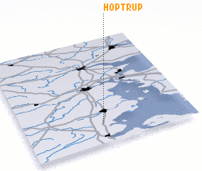 Places with similar names to Hoptrup, Denmark :: Disclaimer :: Information on this page comes without warranty of any kind |
||
|
Where is Hoptrup? Elevation and coordinates ::
Latitude (lat): 55°11'0"N Longitude (lon): 9°28'0"E
Elevation (approx.): 12m (map arrows pan, magnifying glasses zoom) |
||
|
Visiting Hoptrup? Hotel/Accommodation ::
Book a hotel in Hoptrup Travel Guide ::
Buy a travel guide for Denmark rental cars ::
car rental offers GPS waypoint ::
download a GPX waypoint (PoI) of Hoptrup for your GPS receiver
|
||