|
search place name
|
||
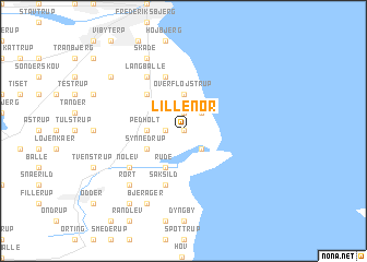
Lillenor (Århus, Denmark)Lillenor is a town in the Århus region of Denmark. An overview map of the region around Lillenor is displayed below.
regional and 3d topo map of Lillenor, Denmark ::
Lillenor airports ::
The nearest airport is AAR - Aarhus, located 37.5 km north east of Lillenor.
Other airports nearby include ODE - Odense (62.2 km south), KRP - Karup (75.8 km north west), BLL - Billund (76.1 km south west), SKS - Skrydstrup (109.3 km south west), Nearby towns ::
Storenor (0.0km north) //
Ajstrup (0.0km north) //
Neder Fløjstrup (1.9km north) //
Starup (1.0km west) //
Kysing (2.1km south east) //
Norsminde (2.1km south east) //
Ajstrup Strand (2.1km north east) //
Pedholt (2.1km west) //
Over Fløjstrup (3.7km north) //
Synnedrup (2.8km south west) //
Rude (3.8km south) //
Beder (4.2km north west) //
Fulden (5.7km north) //
Saksild (5.7km south) //
Langballe (5.9km north) //
Assedrup (4.8km south west) //
Nølev (4.8km south west) //
Rørt (6.4km south west) //
Bjerager (7.7km south) //
Skåde (7.7km north) //
Neder Randlev (8.0km south west) //
Hørret (6.9km north west) //
[all distances 'as the bird flies' and approximate] 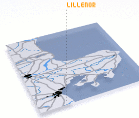 Places with similar names to Lillenor, Denmark ::
// La Leonera (PA)
// La Leonor (CU)
// La Leonera (CL)
// La Leonera (CL)
// La Lenor (CO)
// La Leonera (CO)
// La Llanura (CO)
// Louli Niar (SN)
// La Leonera (VE)
// La Llanera (VE)
Disclaimer :: Information on this page comes without warranty of any kind |
||
|
Where is Lillenor? Elevation and coordinates ::
Latitude (lat): 56°2'0"N Longitude (lon): 10°15'0"E
Elevation (approx.): 22m (map arrows pan, magnifying glasses zoom) |
||
|
Visiting Lillenor? Hotel/Accommodation ::
Book a hotel in Lillenor Travel Guide ::
Buy a travel guide for Denmark rental cars ::
car rental offers GPS waypoint ::
download a GPX waypoint (PoI) of Lillenor for your GPS receiver
|
||