|
search place name
|
||
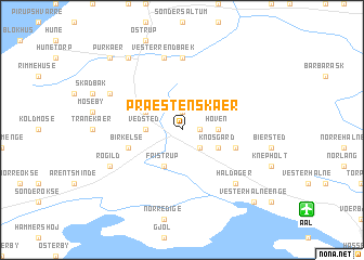
Præstens Kær (Nordjylland, Denmark)Præstens Kær is a town in the Nordjylland region of Denmark. An overview map of the region around Præstens Kær is displayed below.
regional and 3d topo map of Præstens Kær, Denmark ::
Præstens Kær airports ::
The nearest airport is AAL - Aalborg, located 10.8 km south east of Præstens Kær.
Other airports nearby include TED - Thisted (63.2 km west), KRP - Karup (103.7 km south), AAR - Aarhus (110.7 km south east), KRS - Kristiansand Kjevik (151.7 km north west), Nearby towns ::
Skovengene (1.9km north) //
Åby (1.0km east) //
Åbybro (2.1km south east) //
Vedsted (2.0km west) //
Hoven (2.0km east) //
Mergelsbæk (2.7km north west) //
Fristrup (3.8km south) //
Knøsgård (2.7km south east) //
Birkelse (3.5km south west) //
Græsrimmen (3.5km south east) //
Øster Rendbæk (7.4km north) //
Rendbæk (7.5km north) //
Vester Rendbæk (7.5km north) //
Haldager (6.3km south east) //
Kås (5.5km north west) //
Røgild (5.5km south west) //
Pandrup (8.0km north) //
Purkær (8.4km north west) //
Kvorup (8.4km north west) //
Vester Halne Enge (8.4km south east) //
[all distances 'as the bird flies' and approximate] 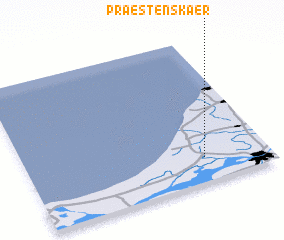 Places with similar names to Præstens Kær, Denmark :: Disclaimer :: Information on this page comes without warranty of any kind |
||
|
Where is Præstens Kær? Elevation and coordinates ::
Latitude (lat): 57°10'0"N Longitude (lon): 9°44'0"E
Elevation (approx.): 5m (map arrows pan, magnifying glasses zoom) |
||
|
Visiting Præstens Kær? Hotel/Accommodation ::
Book a hotel in Præstens Kær Travel Guide ::
Buy a travel guide for Denmark rental cars ::
car rental offers GPS waypoint ::
download a GPX waypoint (PoI) of Præstens Kær for your GPS receiver
|
||