|
search place name
|
||
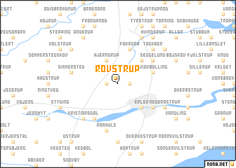
Rovstrup (Sønderjylland, Denmark)Rovstrup is a town in the Sønderjylland region of Denmark. An overview map of the region around Rovstrup is displayed below.
regional and 3d topo map of Rovstrup, Denmark ::
Rovstrup airports ::
The nearest airport is SKS - Skrydstrup, located 13.5 km south west of Rovstrup.
Other airports nearby include SGD - Soenderborg Sonderborg (41.7 km south east), BLL - Billund (54.3 km north), ODE - Odense (59.8 km east), EBJ - Esbjerg (62.9 km north west), Nearby towns ::
Moltrup (1.1km east) //
Bramdrup (1.1km west) //
Hjerndrup (3.9km north) //
Erlev (4.3km south east) //
Kokær (4.3km north east) //
Favrvrå (5.7km north) //
Skovbølling (3.7km north east) //
Rørkær (3.7km north east) //
Errested (3.7km north east) //
Haderslev (4.9km south east) //
Fredsted (5.9km south) //
Seggelund (4.9km north east) //
Pamhule (7.5km south) //
Simmersted (4.6km north west) //
Tagkær (6.4km north east) //
Kristiansdal (6.4km south west) //
Hammelev (6.4km south west) //
Christiansfeld (7.7km north) //
Neder Åstrup (5.6km south east) //
Bjerndrup (7.0km north west) //
Anderup (8.1km north west) //
Favstrup (7.0km north east) //
Hvinderup (8.1km north east) //
[all distances 'as the bird flies' and approximate] 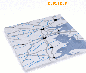
Disclaimer :: Information on this page comes without warranty of any kind |
||
|
Where is Rovstrup? Elevation and coordinates ::
Latitude (lat): 55°17'0"N Longitude (lon): 9°27'0"E
Elevation (approx.): 67m (map arrows pan, magnifying glasses zoom) |
||
|
Visiting Rovstrup? Hotel/Accommodation ::
Book a hotel in Rovstrup Travel Guide ::
Buy a travel guide for Denmark rental cars ::
car rental offers GPS waypoint ::
download a GPX waypoint (PoI) of Rovstrup for your GPS receiver
|
||