|
search place name
|
||
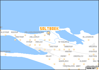
Saltbæk (Vestsjælland, Denmark)Saltbæk is a town in the Vestsjælland region of Denmark. An overview map of the region around Saltbæk is displayed below.
regional and 3d topo map of Saltbæk, Denmark ::
Saltbæk airports ::
The nearest airport is ODE - Odense, located 57.2 km south west of Saltbæk.
Other airports nearby include RKE - Copenhagen Roskilde (66.0 km east), AAR - Aarhus (70.3 km north west), CPH - Copenhagen Kastrup (97.7 km east), JLD - Landskrona (112.3 km east), Nearby towns ::
Illerup (1.9km south) //
Svenstrup (1.0km west) //
Brokkebjerg (2.1km south west) //
Gåsetofte (3.7km south) //
Lille Vrøj (2.8km north east) //
Raklev (4.3km south west) //
Vollerup Overdrev (3.1km west) //
Kåstrup (5.7km south) //
Vollerup (3.6km south west) //
Kalundborg (5.7km south) //
Ellede (4.9km south west) //
Spangsbro (5.9km south) //
Istebjerg (4.9km south east) //
Kalundborg Slots Ladegård (5.9km south) //
Kallerup (4.6km south west) //
Tømmerup (6.4km south east) //
Andaks (6.4km south east) //
Nyrup (5.6km south west) //
Ubberup (7.0km south east) //
Kærby (8.5km south east) //
[all distances 'as the bird flies' and approximate] 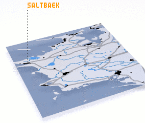 Places with similar names to Saltbæk, Denmark ::
// Saltabak (RU)
Disclaimer :: Information on this page comes without warranty of any kind |
||
|
Where is Saltbæk? Elevation and coordinates ::
Latitude (lat): 55°44'0"N Longitude (lon): 11°7'0"E
Elevation (approx.): 5m (map arrows pan, magnifying glasses zoom) |
||
|
Visiting Saltbæk? Hotel/Accommodation ::
Book a hotel in Saltbæk Travel Guide ::
Buy a travel guide for Denmark rental cars ::
car rental offers GPS waypoint ::
download a GPX waypoint (PoI) of Saltbæk for your GPS receiver
|
||