|
search place name
|
||
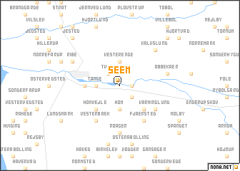
Seem (Ribe, Denmark)Seem is a town in the Ribe region of Denmark. An overview map of the region around Seem is displayed below.
regional and 3d topo map of Seem, Denmark ::
Seem airports ::
The nearest airport is SKS - Skrydstrup, located 29.2 km east of Seem.
Other airports nearby include EBJ - Esbjerg (29.3 km north west), BLL - Billund (51.3 km north east), GWT - Westerland Sylt (54.8 km south west), SGD - Soenderborg Sonderborg (72.6 km south east), Nearby towns ::
Varming (1.1km east) //
Tved (2.1km north west) //
Favrlund (2.1km south east) //
Tange (2.1km west) //
Vesterenge (3.7km north) //
Høm (3.7km south) //
Hømvejle (4.3km south west) //
Hømlund (4.3km south east) //
Lustrup (3.2km west) //
Vesterbæk (5.9km south) //
Fjærsted (5.9km south) //
Varminglund (4.9km south east) //
Roager (7.4km south) //
Obbekær (4.6km north east) //
Kalvslund (6.4km north east) //
Ribe (5.6km north west) //
Jested (8.5km north west) //
Bavngård (8.5km north east) //
[all distances 'as the bird flies' and approximate] 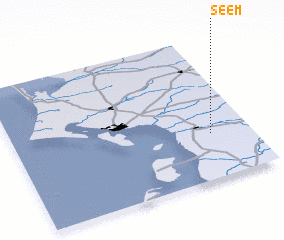 Places with similar names to Seem, Denmark ::
Disclaimer :: Information on this page comes without warranty of any kind |
||
|
Where is Seem? Elevation and coordinates ::
Latitude (lat): 55°19'0"N Longitude (lon): 8°50'0"E
Elevation (approx.): 1m (map arrows pan, magnifying glasses zoom) |
||
|
Visiting Seem? Hotel/Accommodation ::
Book a hotel in Seem Travel Guide ::
Buy a travel guide for Denmark rental cars ::
car rental offers GPS waypoint ::
download a GPX waypoint (PoI) of Seem for your GPS receiver
|
||