|
search place name
|
||
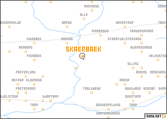
Skærbæk (Ringkøbing, Denmark)Skærbæk is a town in the Ringkøbing region of Denmark. An overview map of the region around Skærbæk is displayed below.
regional and 3d topo map of Skærbæk, Denmark ::
Skærbæk airports ::
The nearest airport is STA - Stauning, located 24.6 km west of Skærbæk.
Other airports nearby include KRP - Karup (36.7 km north east), BLL - Billund (43.3 km south east), EBJ - Esbjerg (59.4 km south), SKS - Skrydstrup (97.7 km south), Nearby towns ::
Nørre Vium (2.1km south west) //
Vorgod (4.2km north west) //
Rimmerhus (5.9km north) //
Troldhede (7.5km south) //
Barde (7.7km north) //
Albæk Hede (6.9km south east) //
[all distances 'as the bird flies' and approximate] 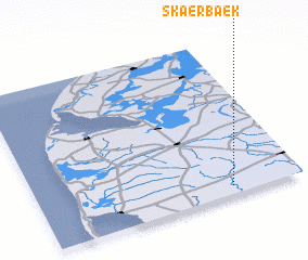 Places with similar names to Skærbæk, Denmark ::
// Skarbka (PL)
// Skarbki (PL)
// Zagróbka (PL)
// Zagrobki (PL)
// Skribakiai (LT)
// Cikurubuk (ID)
// Sakorobougou (ML)
// Sikorobougou (ML)
// Sokoribougou (ML)
// Schaarbeek (BE)
Disclaimer :: Information on this page comes without warranty of any kind |
||
|
Where is Skærbæk? Elevation and coordinates ::
Latitude (lat): 56°3'0"N Longitude (lon): 8°44'0"E
Elevation (approx.): 34m (map arrows pan, magnifying glasses zoom) |
||
|
Visiting Skærbæk? Hotel/Accommodation ::
Book a hotel in Skærbæk Travel Guide ::
Buy a travel guide for Denmark rental cars ::
car rental offers GPS waypoint ::
download a GPX waypoint (PoI) of Skærbæk for your GPS receiver
|
||