|
search place name
|
||
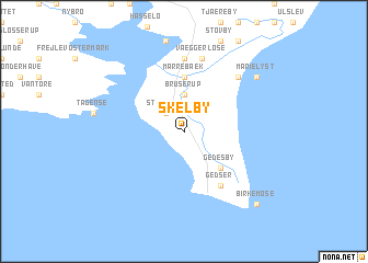
Skelby (Storstrøm, Denmark)Skelby is a town in the Storstrøm region of Denmark. An overview map of the region around Skelby is displayed below.
regional and 3d topo map of Skelby, Denmark ::
Skelby airports ::
The nearest airport is RLG - Laage, located 83.0 km south of Skelby.
Other airports nearby include RKE - Copenhagen Roskilde (106.9 km north), KEL - Kiel Holtenau (118.2 km west), CPH - Copenhagen Kastrup (119.3 km north east), LBC - Luebeck Lubeck Blankensee (120.8 km south west), Nearby towns ::
Stavreby (2.1km north west) //
Bruserup (3.7km north) //
Gedesby (4.3km south east) //
Marrebæk (5.6km north) //
Gedser (6.0km south) //
Rabjerg (7.4km north) //
Væggerløse (7.5km north) //
Højet (7.5km north) //
Bøtø By (6.4km north east) //
Marielyst (7.0km north east) //
Birkemose (8.6km south east) //
[all distances 'as the bird flies' and approximate]  Places with similar names to Skelby, Denmark ::
Disclaimer :: Information on this page comes without warranty of any kind |
||
|
Where is Skelby? Elevation and coordinates ::
Latitude (lat): 54°38'0"N Longitude (lon): 11°55'0"E
Elevation (approx.): -1m (map arrows pan, magnifying glasses zoom) |
||
|
Visiting Skelby? Hotel/Accommodation ::
Book a hotel in Skelby Travel Guide ::
Buy a travel guide for Denmark rental cars ::
car rental offers GPS waypoint ::
download a GPX waypoint (PoI) of Skelby for your GPS receiver
|
||