|
search place name
|
||
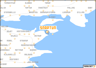
Snaptun (Vejle, Denmark)Snaptun is a town in the Vejle region of Denmark. An overview map of the region around Snaptun is displayed below.
regional and 3d topo map of Snaptun, Denmark ::
Snaptun airports ::
The nearest airport is ODE - Odense, located 41.3 km south east of Snaptun.
Other airports nearby include BLL - Billund (58.0 km west), AAR - Aarhus (63.9 km north east), KRP - Karup (79.4 km north west), SKS - Skrydstrup (83.1 km south west), Nearby towns ::
Hjarnø By (1.0km east) //
Østrup (2.8km south west) //
Nørby (3.1km west) //
Alrø By (5.7km north) //
Sønderby (4.8km south west) //
Sondrup Strand (7.4km north) //
Glud (4.2km west) //
Brigsted (8.0km north west) //
Neder Sønderby (6.9km south west) //
Kirkholm (8.0km south west) //
Hosby (8.0km south west) //
Overby (8.0km south west) //
Amstrup (8.5km north east) //
Lerdrup (8.5km north east) //
[all distances 'as the bird flies' and approximate] 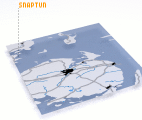 Places with similar names to Snaptun, Denmark ::
// Sinaputon (MY)
Disclaimer :: Information on this page comes without warranty of any kind |
||
|
Where is Snaptun? Elevation and coordinates ::
Latitude (lat): 55°49'0"N Longitude (lon): 10°4'0"E
Elevation (approx.): -32768m (map arrows pan, magnifying glasses zoom) |
||
|
Visiting Snaptun? Hotel/Accommodation ::
Book a hotel in Snaptun Travel Guide ::
Buy a travel guide for Denmark rental cars ::
car rental offers GPS waypoint ::
download a GPX waypoint (PoI) of Snaptun for your GPS receiver
|
||