|
search place name
|
||
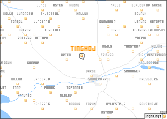
Tinghøj (Ribe, Denmark)Tinghøj is a town in the Ribe region of Denmark. An overview map of the region around Tinghøj is displayed below.
regional and 3d topo map of Tinghøj, Denmark ::
Tinghøj airports ::
The nearest airport is EBJ - Esbjerg, located 16.6 km south of Tinghøj.
Other airports nearby include STA - Stauning (36.7 km north), BLL - Billund (43.8 km east), SKS - Skrydstrup (70.4 km south east), KRP - Karup (81.4 km north east), Nearby towns ::
Blaksmark (2.1km east) //
Orten (2.1km west) //
Varde (3.9km south) //
Frisvad (3.1km east) //
Mejls (3.6km north east) //
Sønder Varde (5.9km south) //
Toftnæs (7.5km south) //
Hindsig (6.4km north east) //
Gellerup (5.6km south east) //
Frøstrup (8.0km north west) //
Gunderup (8.0km north east) //
Horne (7.0km north east) //
Vester Debel (7.0km north west) //
Vibæk (8.5km south west) //
[all distances 'as the bird flies' and approximate] 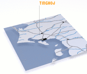
Disclaimer :: Information on this page comes without warranty of any kind |
||
|
Where is Tinghøj? Elevation and coordinates ::
Latitude (lat): 55°40'0"N Longitude (lon): 8°28'0"E
Elevation (approx.): 18m (map arrows pan, magnifying glasses zoom) |
||
|
Visiting Tinghøj? Hotel/Accommodation ::
Book a hotel in Tinghøj Travel Guide ::
Buy a travel guide for Denmark rental cars ::
car rental offers GPS waypoint ::
download a GPX waypoint (PoI) of Tinghøj for your GPS receiver
|
||