|
search place name
|
||
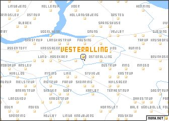
Vester Alling (Århus, Denmark)Vester Alling is a town in the Århus region of Denmark. An overview map of the region around Vester Alling is displayed below.
regional and 3d topo map of Vester Alling, Denmark ::
Vester Alling airports ::
The nearest airport is AAR - Aarhus, located 24.5 km south east of Vester Alling.
Other airports nearby include KRP - Karup (72.8 km west), AAL - Aalborg (79.8 km north), BLL - Billund (103.1 km south west), ODE - Odense (104.7 km south), Nearby towns ::
Fløjstrup (1.0km west) //
Fausing (3.7km north) //
Øster Alling (2.1km east) //
Virring (2.8km north west) //
Lemmer (3.8km south) //
Syvveje (3.8km south) //
Floes (4.2km north west) //
Drammelstrup (4.2km north east) //
Lime (4.2km south west) //
Skørring (5.6km south) //
Mosekær (3.1km west) //
Liltved (3.6km north east) //
Grund (5.7km north) //
Andi (5.7km south) //
Oustrup (3.6km south east) //
Fårup (5.9km south) //
Langkastrup (4.8km north west) //
Hejlskov (4.8km south east) //
Hørning (4.1km west) //
Ammelhede (4.5km north west) //
Krogsager (4.5km north west) //
Karlby (7.5km south) //
Bendstrup (6.4km south east) //
Allingåbro (6.4km north east) //
Bode (7.7km north) //
Mygind (5.5km south west) //
Søby (7.7km south) //
Bøjen (5.5km south east) //
Spangshuse (8.0km north) //
[all distances 'as the bird flies' and approximate] 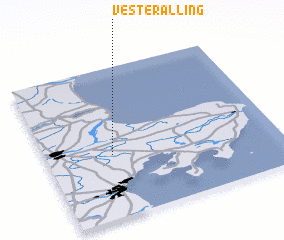 Places with similar names to Vester Alling, Denmark :: Disclaimer :: Information on this page comes without warranty of any kind |
||
|
Where is Vester Alling? Elevation and coordinates ::
Latitude (lat): 56°25'0"N Longitude (lon): 10°17'0"E
Elevation (approx.): 3m (map arrows pan, magnifying glasses zoom) |
||
|
Visiting Vester Alling? Hotel/Accommodation ::
Book a hotel in Vester Alling Travel Guide ::
Buy a travel guide for Denmark rental cars ::
car rental offers GPS waypoint ::
download a GPX waypoint (PoI) of Vester Alling for your GPS receiver
|
||