|
search place name
|
||
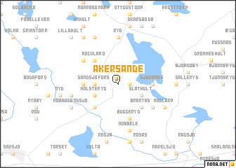
Åkersände (Jönköping, Sweden)Åkersände is a town in the Jönköping region of Sweden. An overview map of the region around Åkersände is displayed below.
regional and 3d topo map of Åkersände, Sweden ::
Åkersände airports ::
The nearest airport is JKG - Joenkoeping Jonkoping, located 53.1 km north west of Åkersände.
Other airports nearby include HLF - Hultsfred (60.4 km east), VXO - Vaxjo Kronoberg (63.8 km south), OSK - Oskarshamn (102.4 km east), LPI - Linkoeping Saab (113.1 km north east), Nearby towns ::
Djurseryd (1.0km east) //
Sandsjöfors (2.0km west) //
Släthult (2.7km south east) //
Holsteryd (2.7km south west) //
Brantås (4.2km south east) //
Möcklamo (4.2km north west) //
Mostorp (4.2km south west) //
Djuvanäs (3.0km east) //
Övrarp (3.0km west) //
Buggeryd (5.6km south) //
Hjärkanstorp (4.8km south east) //
Högagärde (4.8km north west) //
Ryd (7.4km north) //
Nöbbele (7.5km south) //
Ingarp (7.5km south) //
Horsnäs (4.4km south west) //
Bökarp (5.4km south east) //
Naglarp (5.4km south east) //
Norra Sandsjö (5.4km south west) //
Hälleved (7.7km north) //
Kroxås (8.0km north) //
Lilla Hult (8.4km north west) //
[all distances 'as the bird flies' and approximate] 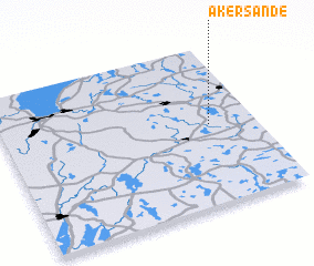
Disclaimer :: Information on this page comes without warranty of any kind |
||
|
Where is Åkersände? Elevation and coordinates ::
Latitude (lat): 57°30'0"N Longitude (lon): 14°49'0"E
Elevation (approx.): 239m (map arrows pan, magnifying glasses zoom) |
||
|
Visiting Åkersände? Hotel/Accommodation ::
Book a hotel in Åkersände Travel Guide ::
Buy a travel guide for Sweden rental cars ::
car rental offers GPS waypoint ::
download a GPX waypoint (PoI) of Åkersände for your GPS receiver
|
||